Landscape In-Between
#ambiguity #territory #odd land #policy #autonomy
Exhibitor
Ping-Sheng WU,
Shih-Hua YEN,
Po-Min KUNG
Team Member
Yi-Hsien TSENG,
Yen-Shan LEE,
Xiao-Pei CHANG,
Yi-Fang LAI,
Ting-Chen WU,
Tsai-Yu HUANG,
Po-Yuan SU,
Jasmine KUO
View the Printed Edition (PDF)
Ambiguous Space: Observations on Urban Space in Tainan
Preface
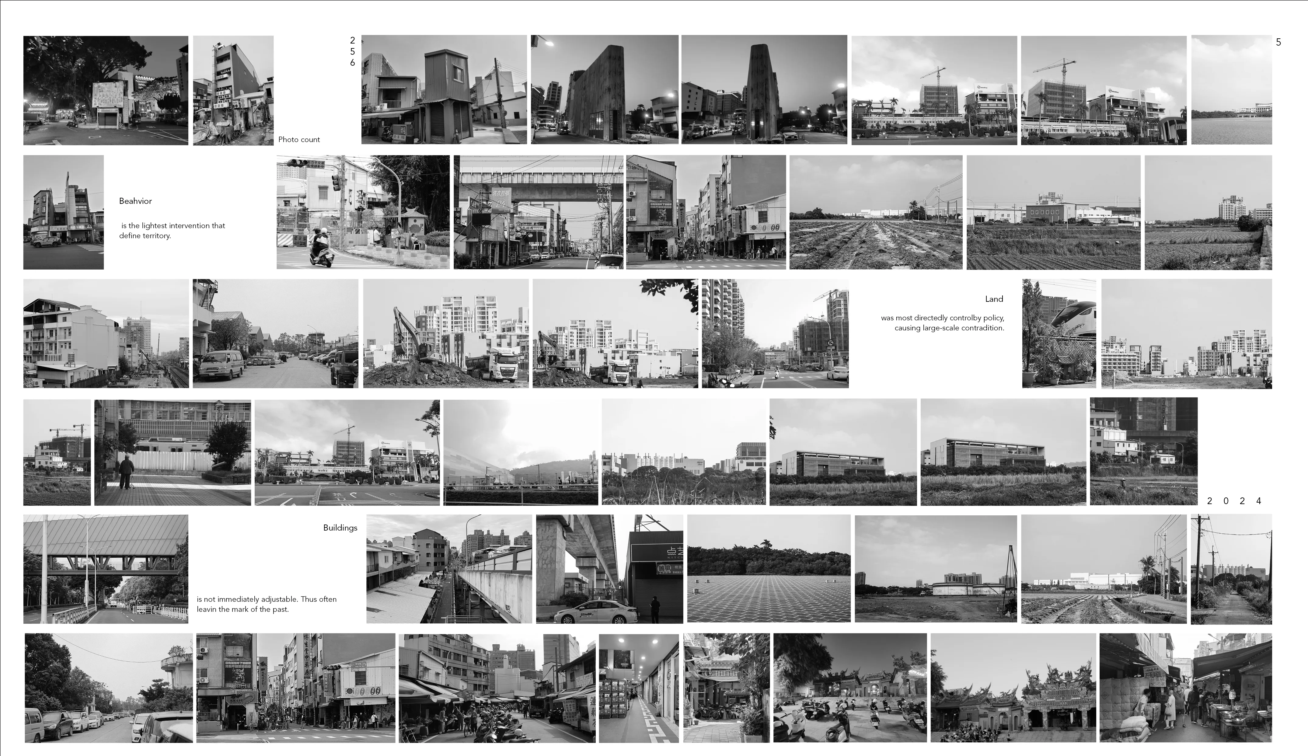
Using imagery for research and observation, this exhibition focuses on Tainan, Taiwan, documenting “grey space” phenomena at multiple scales—from street-corner lots downtown to industrial parks on the outskirts. These sites reveal the tension between government planning and grassroots autonomy, exposing contradictions and negotiations between top-down strategies and spontaneous local actions. Taken together, they offer a dynamic portrait of a city in flux.Urban planning across different eras typically. Urban planning across different eras typically imposes invisible boundaries to define ownership and public–private divisions, yet everyday life rarely fits such neat lines. Each period’s approach to land overlaps with residents’ subtle yet meaningful autonomy, shaping the city’s evolving landscape.Through photographs of vacant lots, temporary structures, and undefined open spaces, this study uncovers social and cultural interactions across diverse scales. Although these “grey spaces” defy strict categorization, they reflect both the transient nature of urban growth and human adaptability under policy constraints. This research encourages a reconsideration of architecture and urban design—exploring how new design values can arise amid ambiguity and how more balanced spatial strategies can be realized at different scales.
 Ambiguous Space: Observations on Urban Space in Tainan
The Greyness in The Space
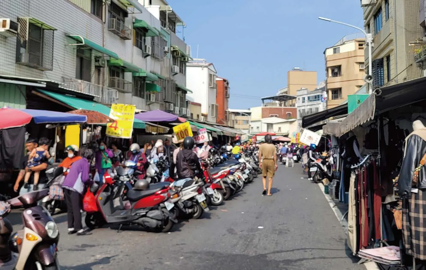
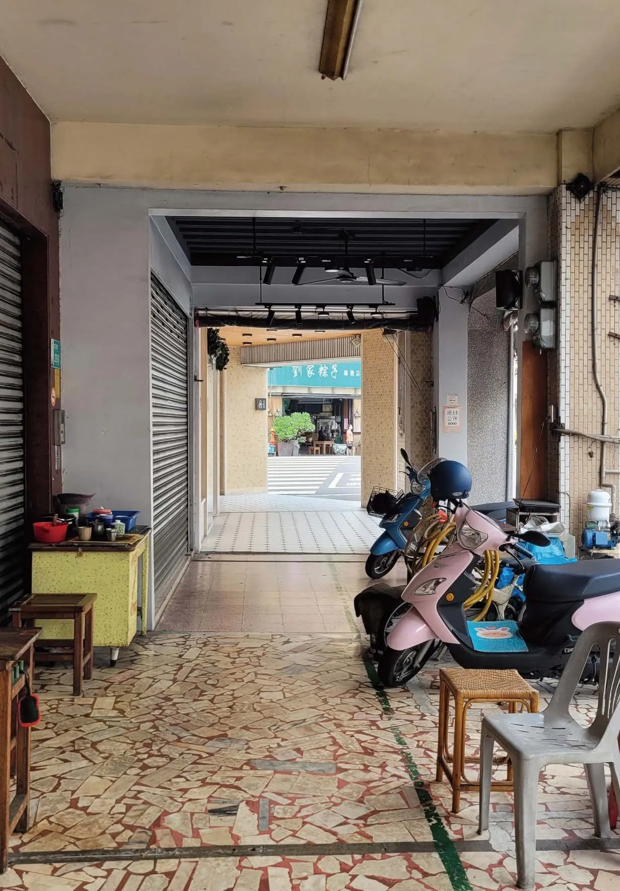
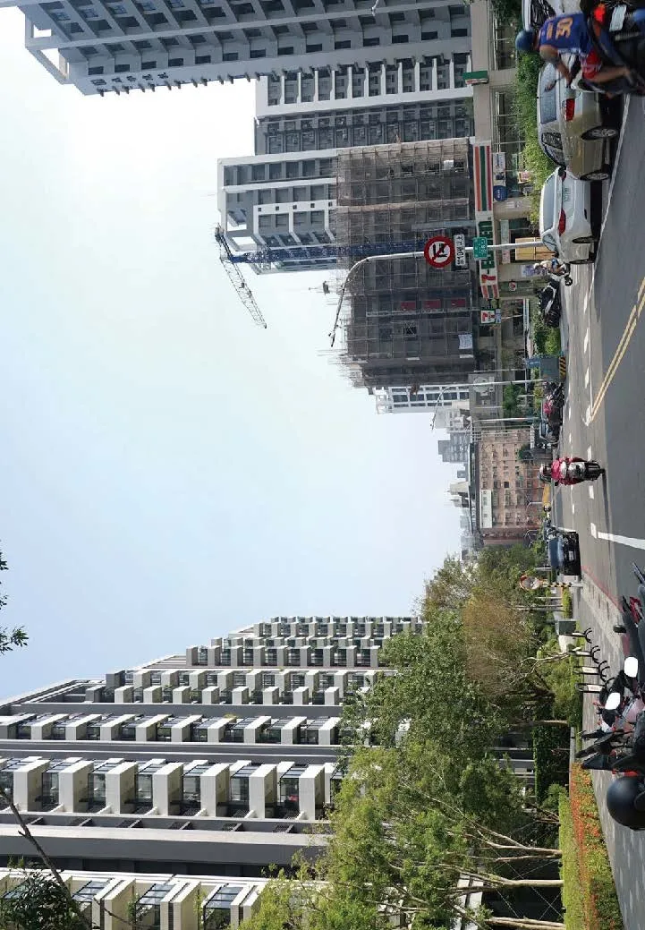
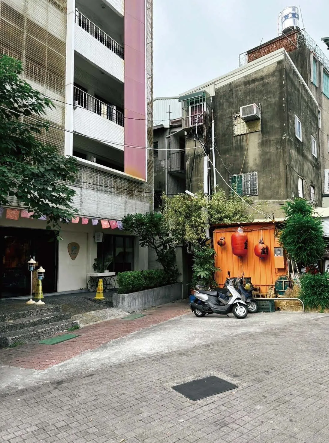
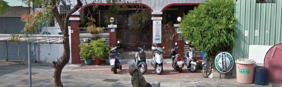
In modern urban development, we often see spaces situated between public and private,formal and informal—commonly known as “grey spaces.” On official maps, they may be labeled as “vacant lots” or “areas for future development,”yet they frequently encompass layers of social interaction and cultural significance. In Tainan,for instance, from modest street-corner lots in the city center to wide expanses of underutilized land in outlying industrial areas, local residents continually adapt, reshape, and revitalize these pockets. Their endeavors reveal a fluid landscape where government policy intersects with organic,community-driven actions—creating a microcosm that mirrors the broader complexities of Taiwan’s urban evolution.
Typically, government-led planning focuses on goals such as economic prosperity, a polished city image, and standardized infrastructure,achieved through various regulations and zoning frameworks. However, everyday life seldom adheres strictly to such boundaries; the day-to-day habits, traditions, and improvisational strategies of citizens permeate these delineations. In many instances, people embrace grey spaces by setting up roadside stalls, growing small gardens, or repurposing tiny leftover parcels of land—actions that illustrate the capacity of individuals and communities to forge functional, personalized environments beyond the scope of oversight.
Tainan’s urban tapestry reflects its diverse historical layers, shifting economic foundations,and an array of planning philosophies. Within its older districts, remnants of Qing-era street layouts coexist with Baroque influences from the Japanese colonial period, forming a collage of narrow lanes and unexpected nodes. Some parcels,deemed unprofitable or impractical due to their size or shape, instead become gathering points,urban oases, or places of spontaneous creativity.Meanwhile, the meteoric rise of the semiconductor industry has led to the development of sprawling industrial parks and satellite towns, producing stark contrasts with surrounding farmland and traditional neighborhoods. Substantial projects,including Tainan’s railway undergrounding,introduce new linear corridors and open up possibilities for grey spaces, while also presenting challenges for stakeholders
Far from being mere placeholders or residual pockets, these spaces underscore the city’s flexibility and potential for grassroots innovation.Some arise from negotiations between authorities and communities, while others take shape as unregulated yet functional endeavors. Their ambiguities in ownership and use can complicate governance, sanitation, or safety, but also inspire inventive design and neighborhood spirit. Excessive enforcement might eliminate these everyday laboratories of urban life, yet total neglect could breed uncertainty or hazards.
From an architectural and urban design standpoint,grey spaces highlight local resourcefulness, forging immediate social networks and pointing toward fresh directions in development. This perspective suggests that urban planning can profit from looking beyond rigid zoning codes, embracing transitional arenas as valuable testbeds for new ideas. By recognizing the underlying social, cultural,and spatial interplay in these areas, policymakers and designers alike can craft more inclusive,flexible strategies. Ultimately, grey spaces act not as loopholes in the system, but rather as mirrors reflecting urban complexity and human resilience.By valuing and carefully integrating such inbetween landscapes, Tainan—and other rapidly evolving cities—can strike a balance between topdown directives and grassroots ingenuity, fostering more dynamic and human-centered environments that safeguard a harmonious coexistence among people, land, and architecture.
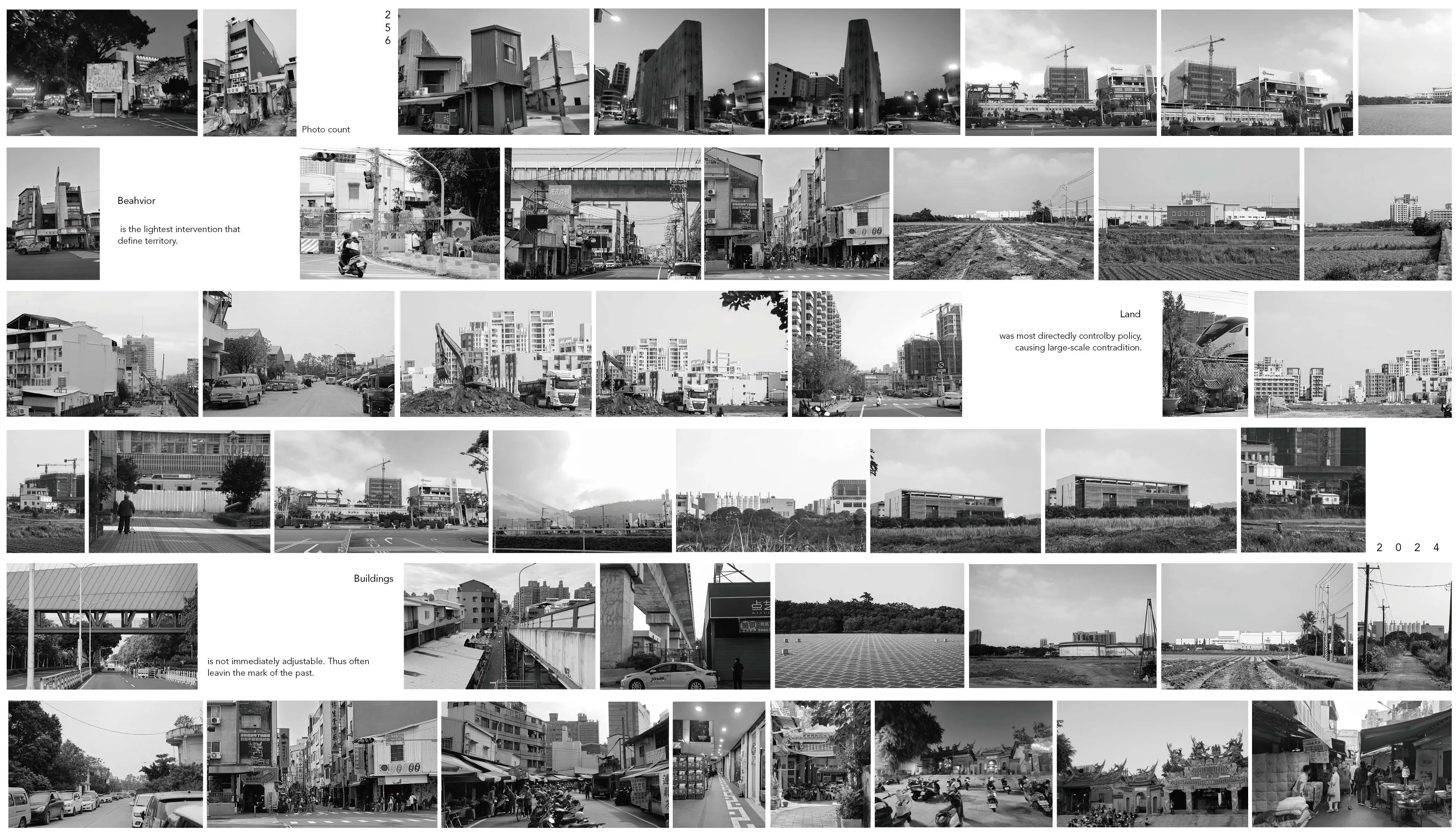
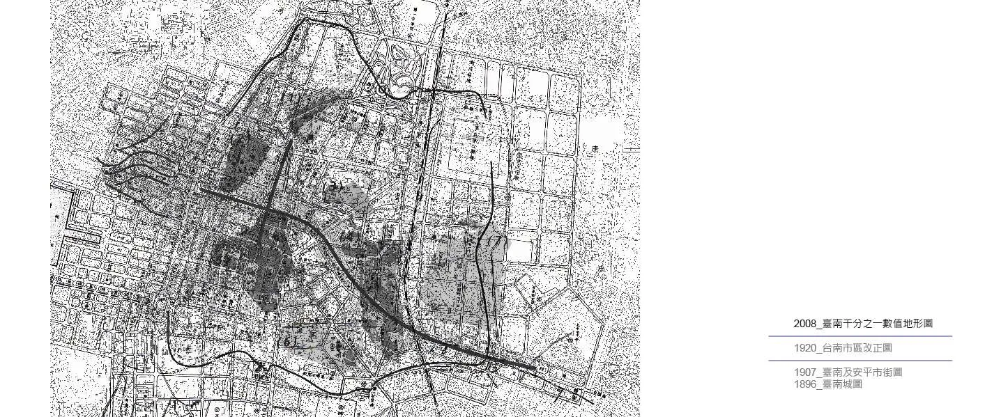
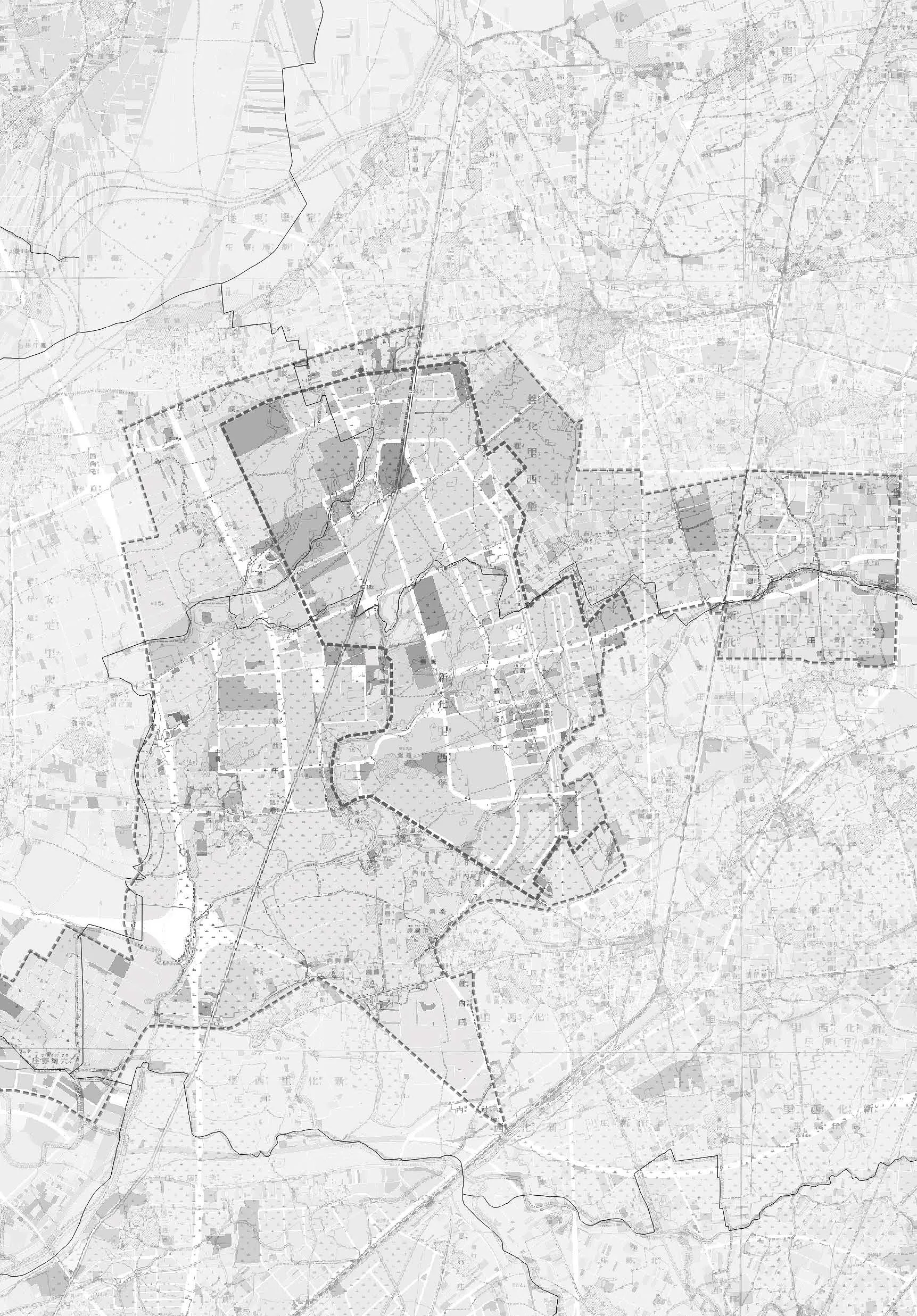
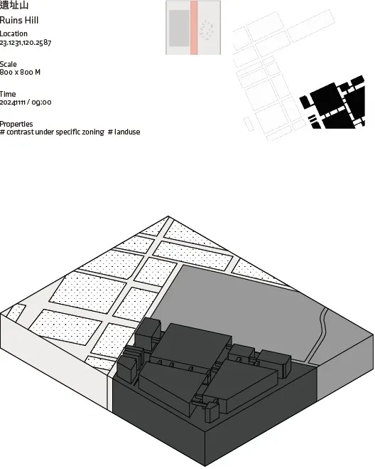
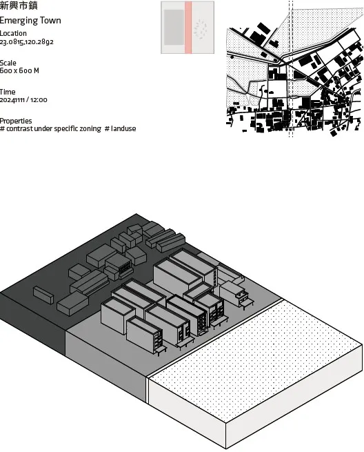
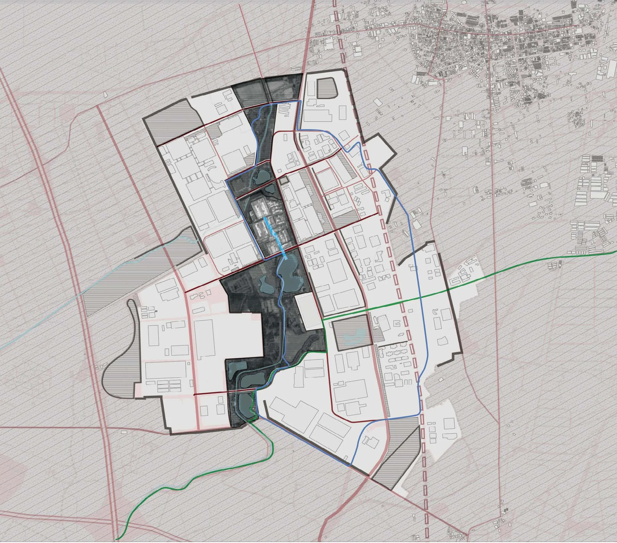
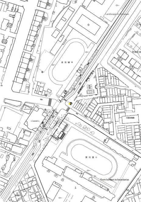
Geographic Index of Tainan
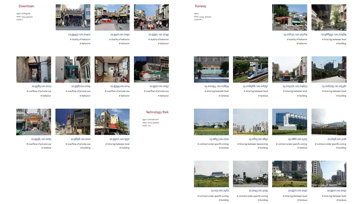
In urban development, the gap between formal planning and informal use often gives rise to “grey spaces.” Shaped at various scales and contexts—such as old city districts, railway-underground zones, and the Southern Taiwan Science Park—these spaces reveal multi-layered dynamics.In historic areas, temple courtyards serve both religious and temporary market functions, while arcades and alleys near markets become quasipublic due to long-term use. Idle land from railway undergrounding and fenced-off corridors act as short-term or transitional zones. Meanwhile,at the science park, expansive plots between industrial facilities and farmland underscore greater uncertainties. Grey spaces are products of urban transformation and hold potential for future development, reflecting the interplay between policy and grassroots action through their flexibility and ambiguity. By embracing uncertainty and adopting more adaptive spatial strategies,these grey spaces can become valuable assets for urban growth rather than blind spots in governance.
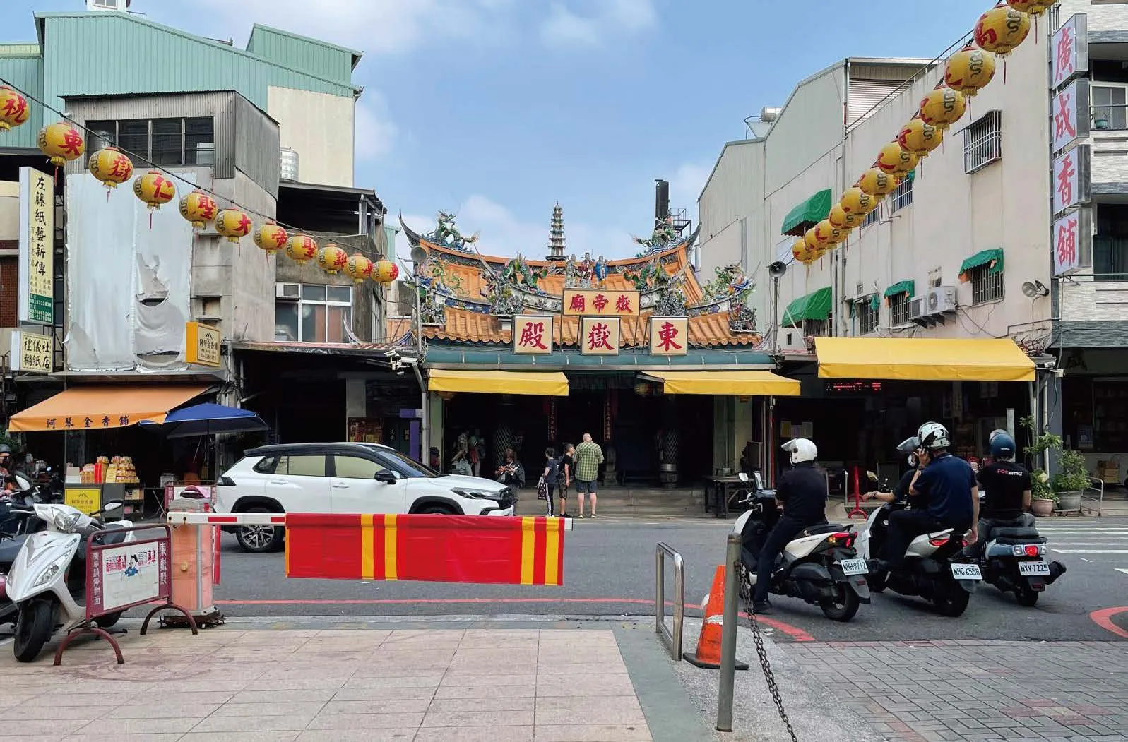
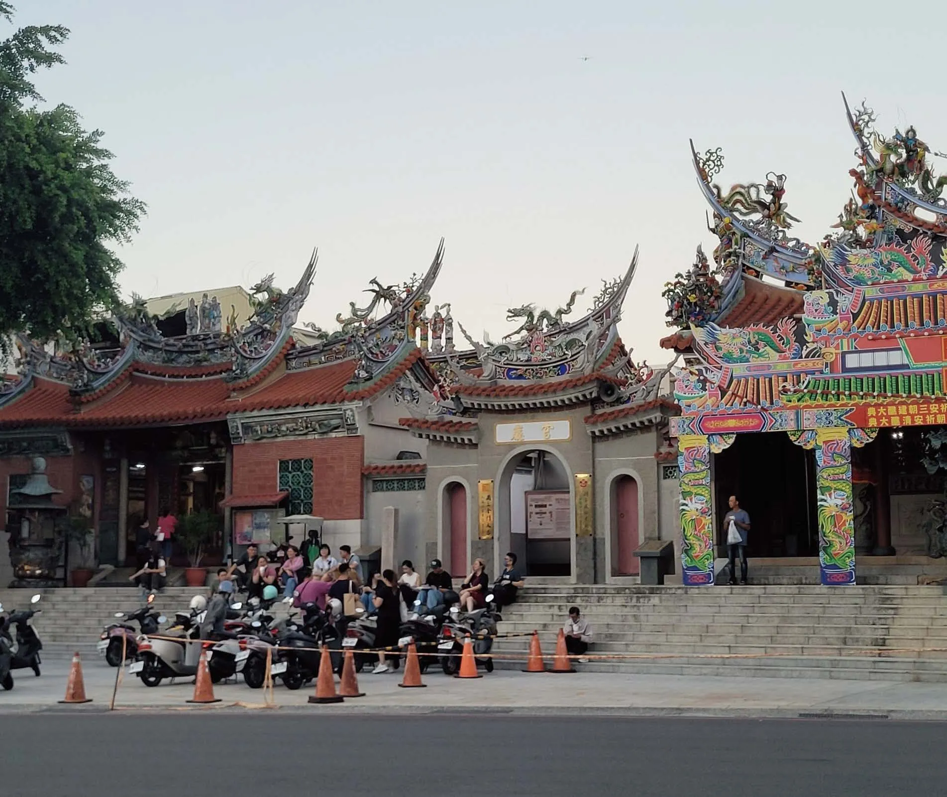 Temple courtyard: core of worship, pop-up social space.
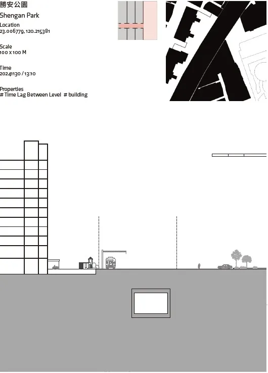
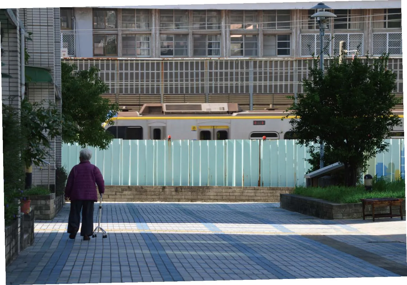
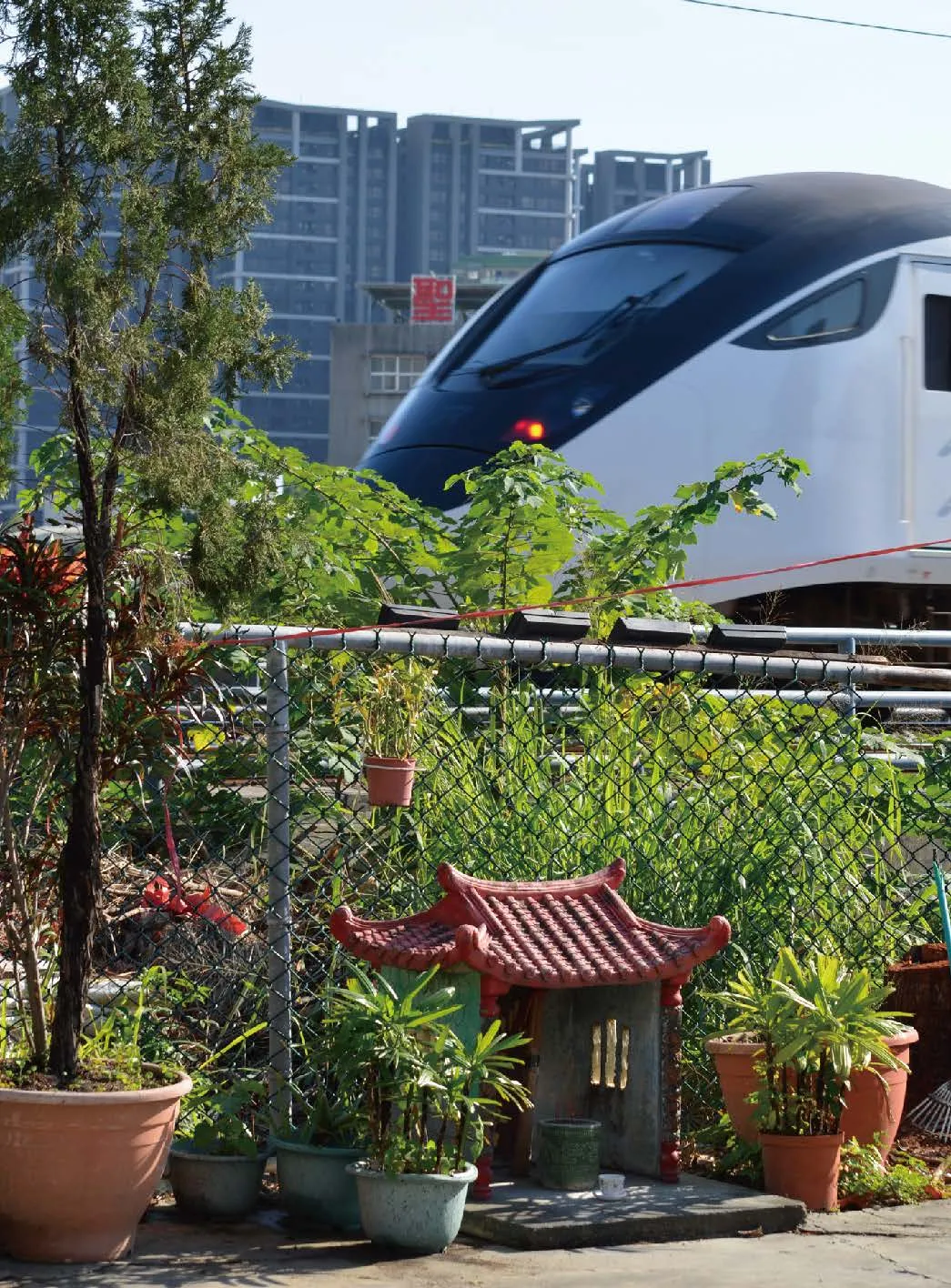
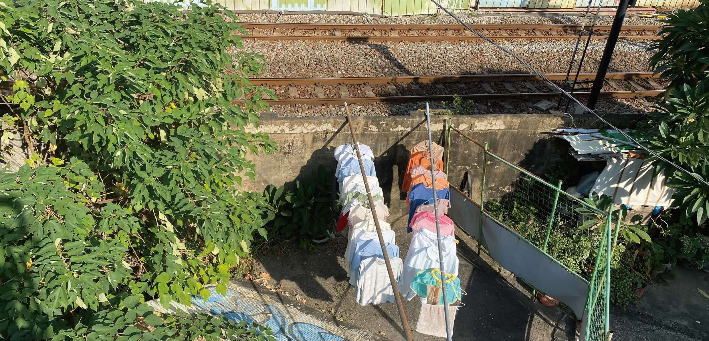
 Railway-underground fencing meets everyday residential life.
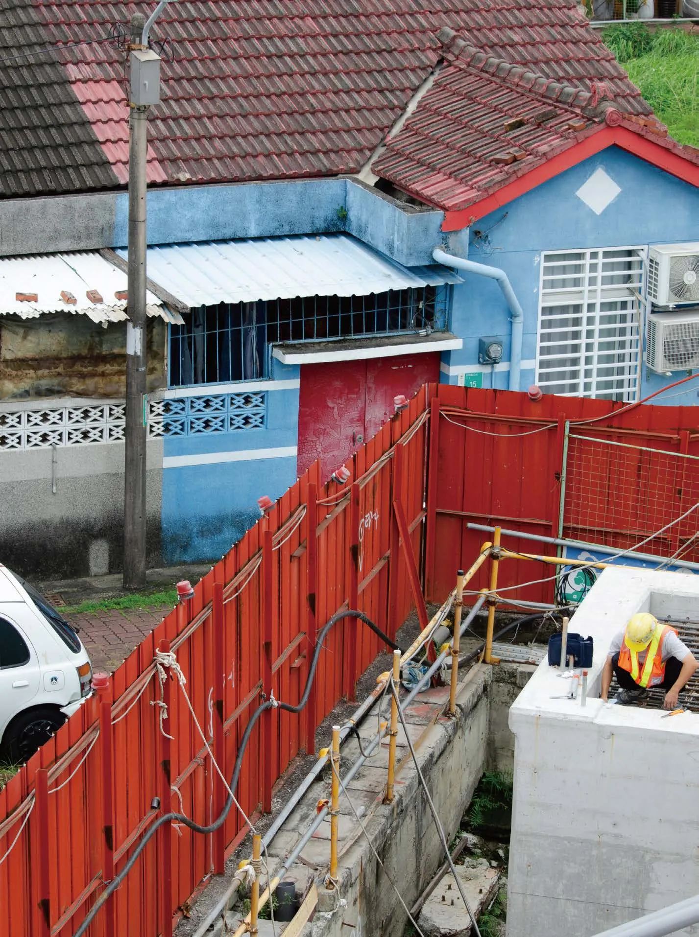
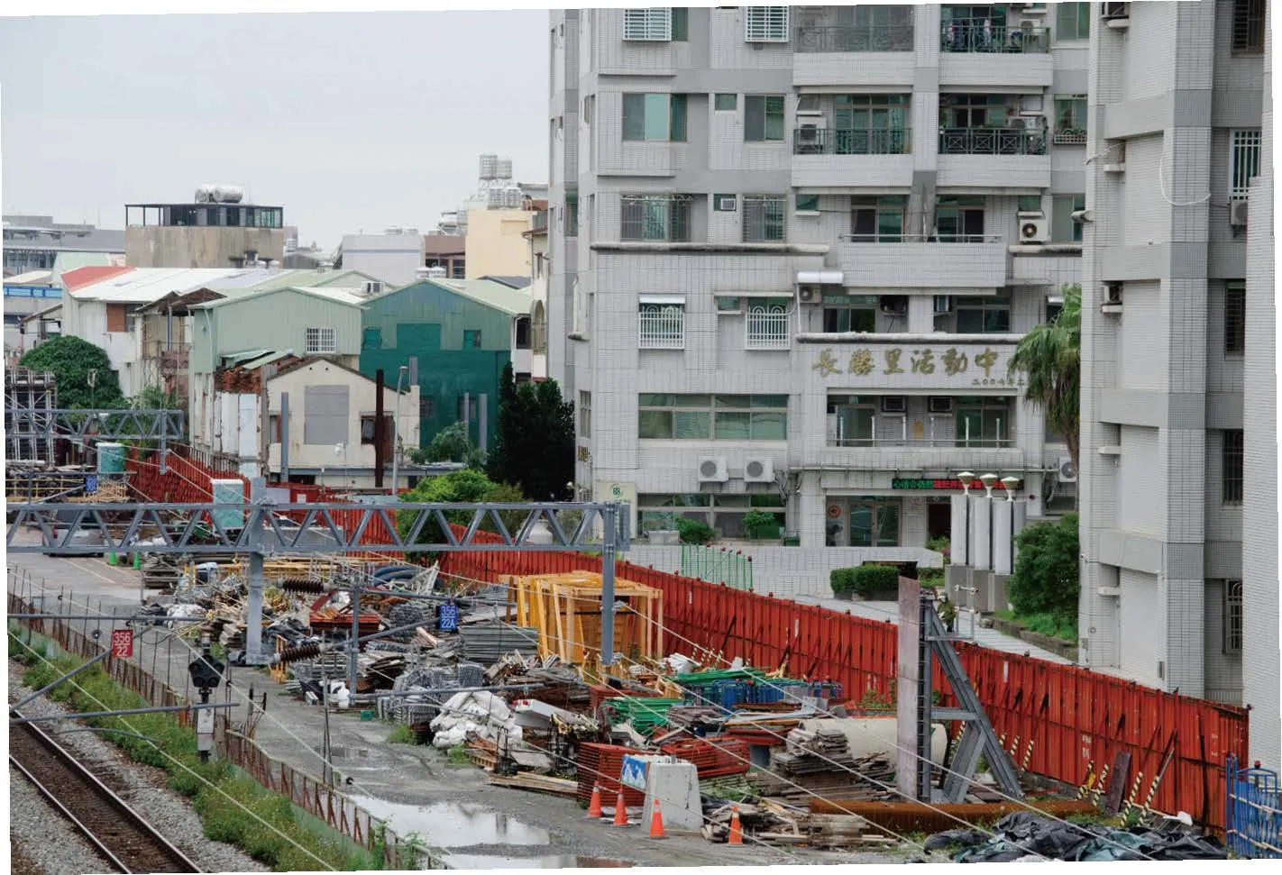
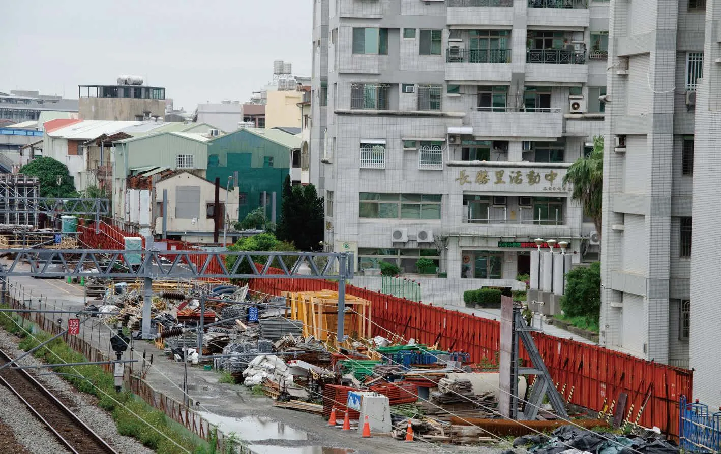 Construction fencing forms boundaries and evokes undefined spatial concepts.
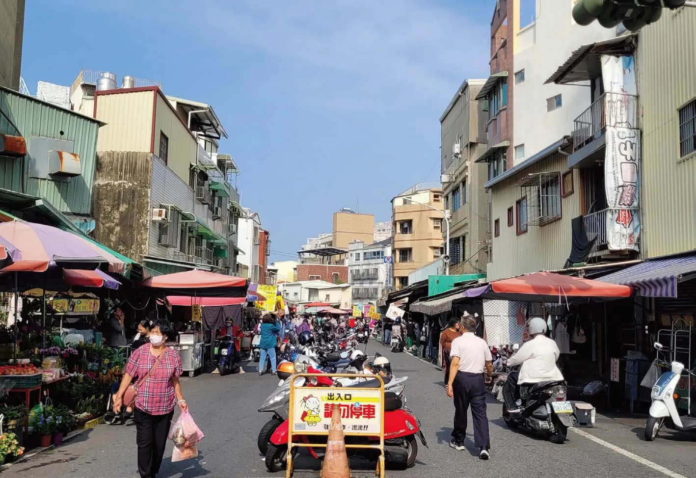
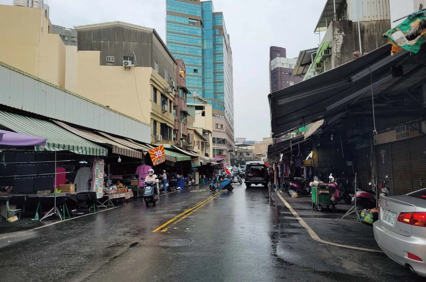
 Street turned into a makeshift morning market.
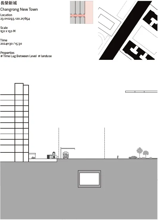
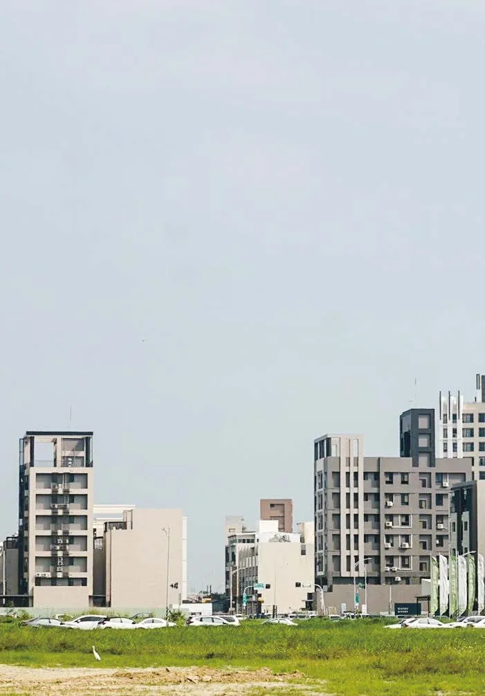
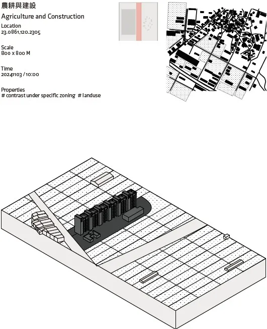
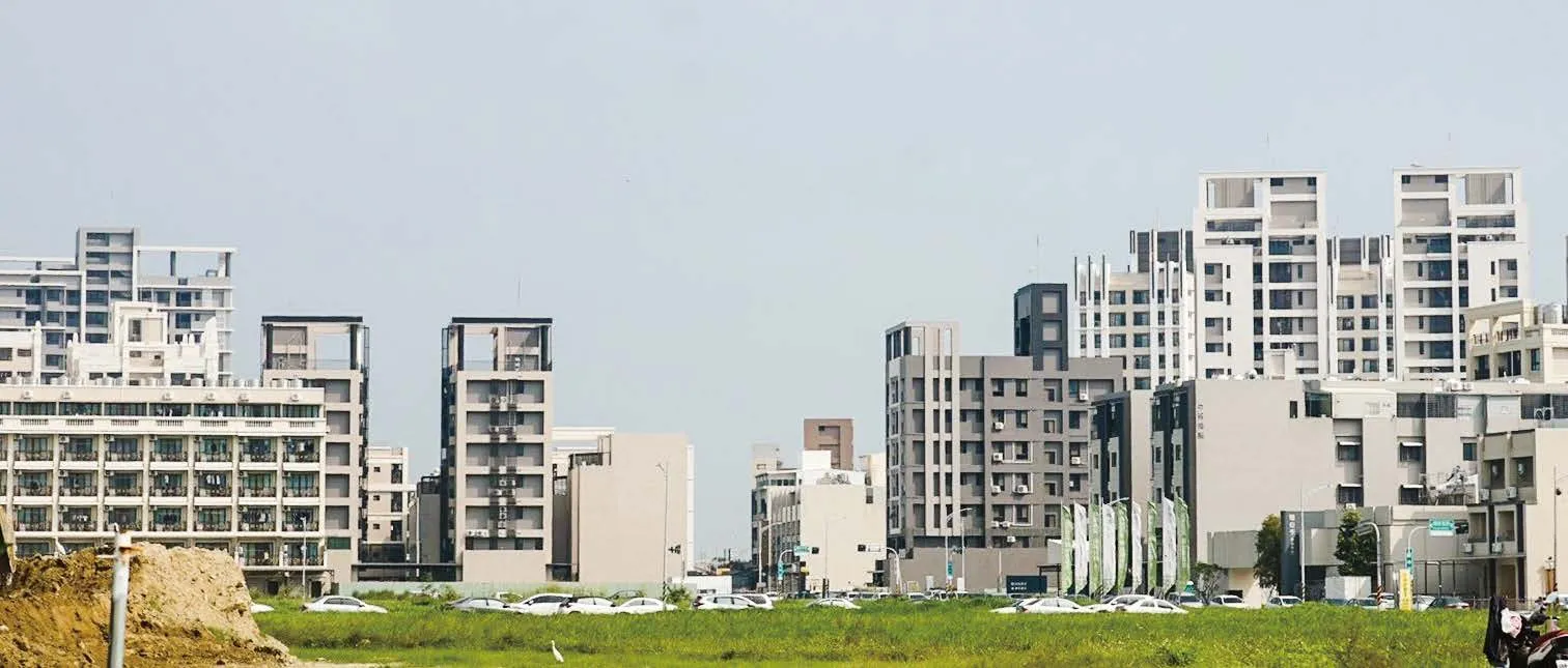 Residential area driven by tech-industry demand.
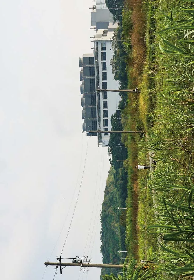
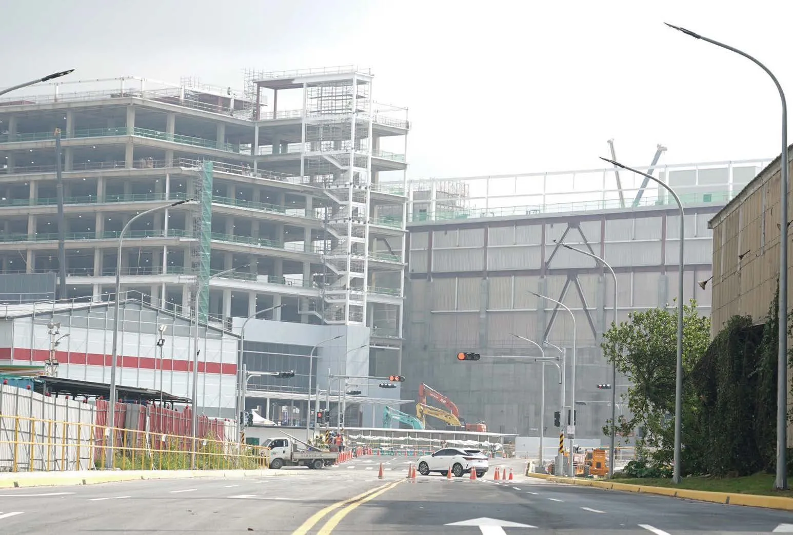
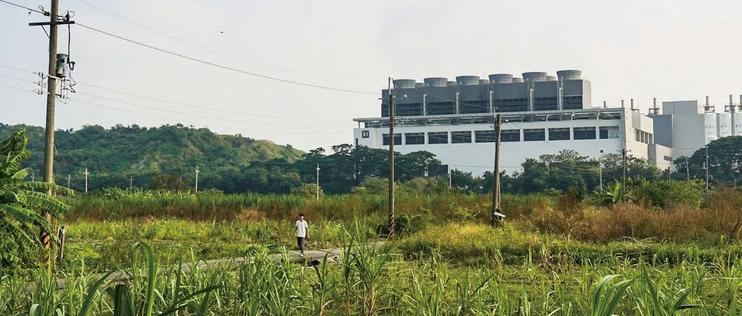 Tech factories rising alongside farmland.
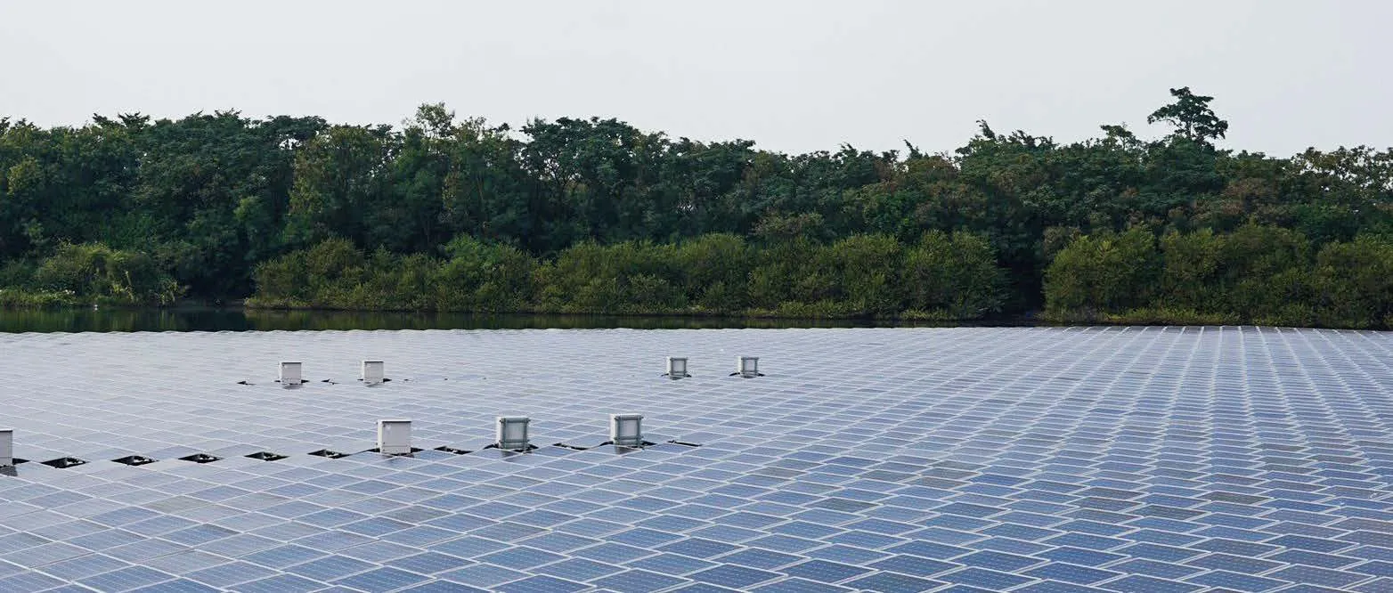
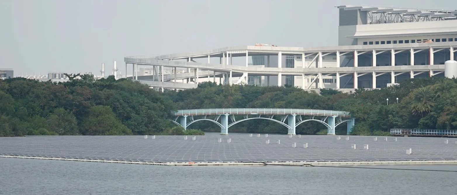 Fish ponds topped with solar panels next to tech factories.
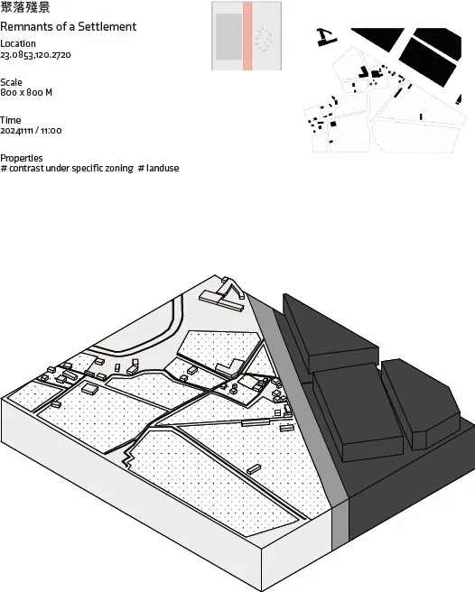
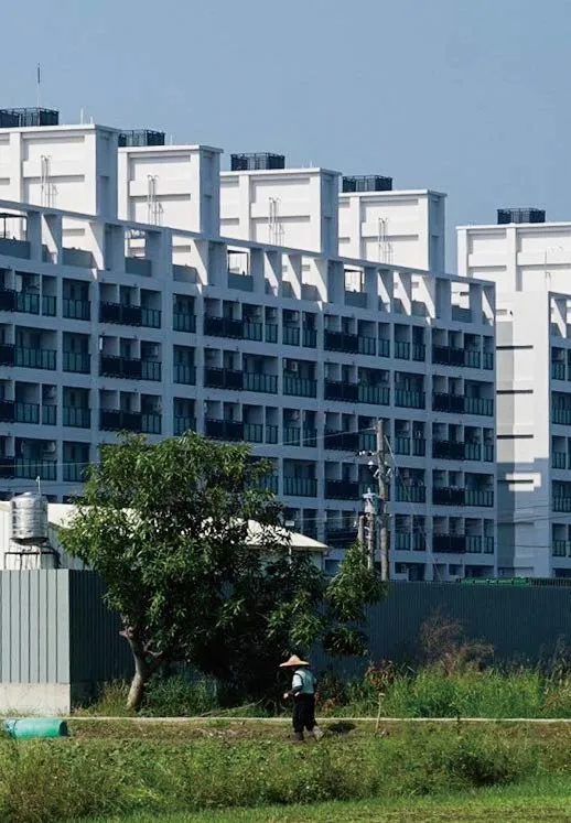
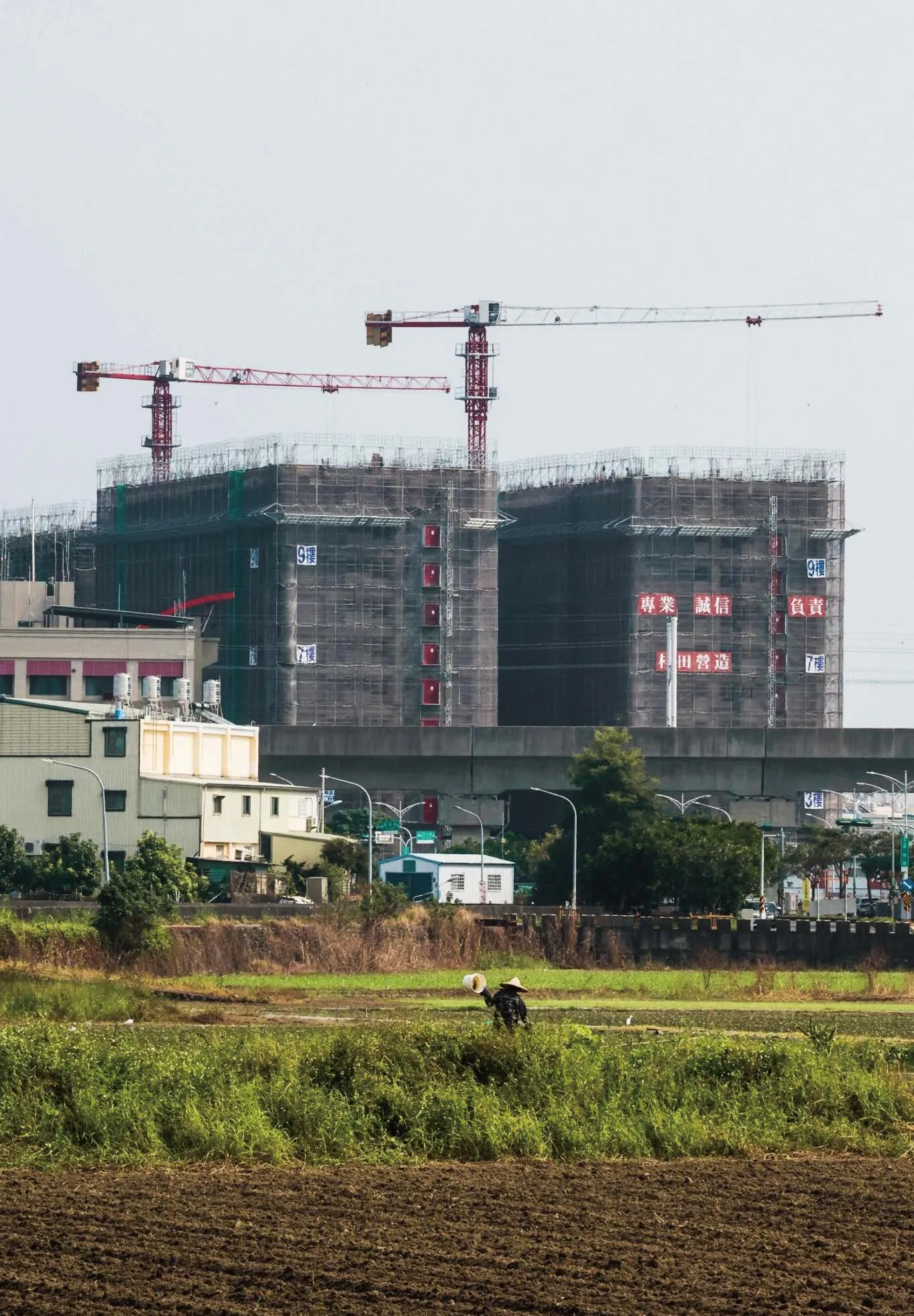
 A “grey” phenomenon where farming coexists with high-rise construction.
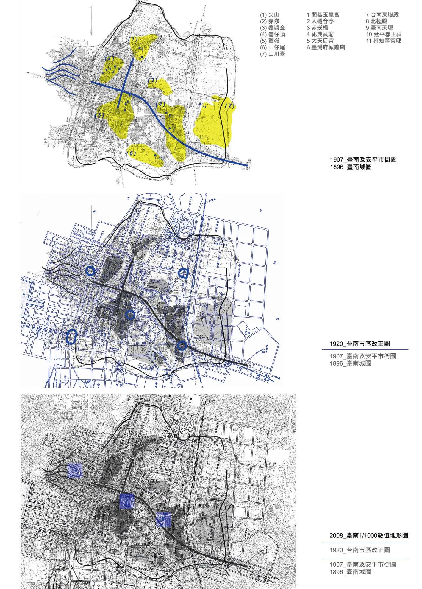
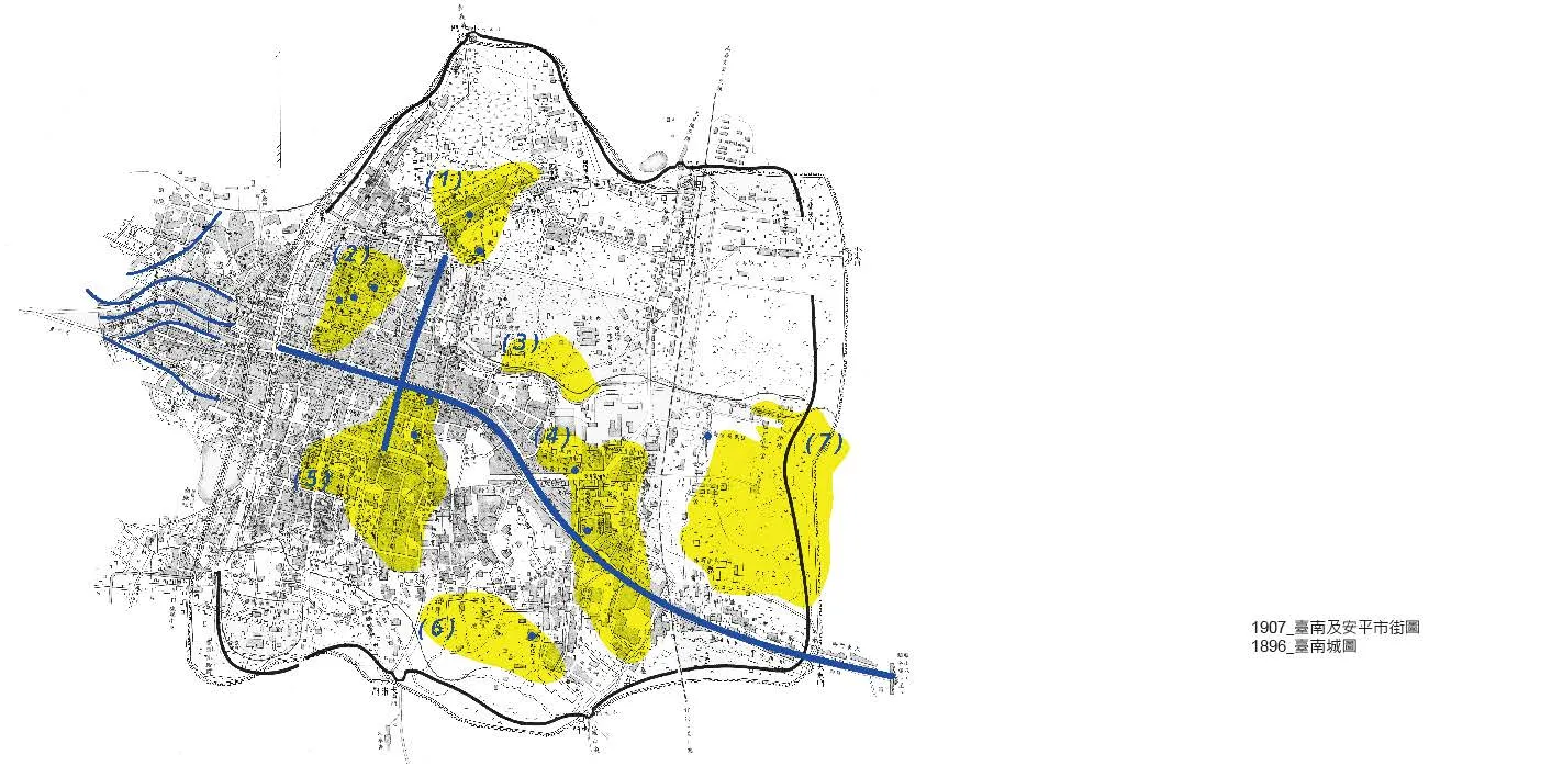
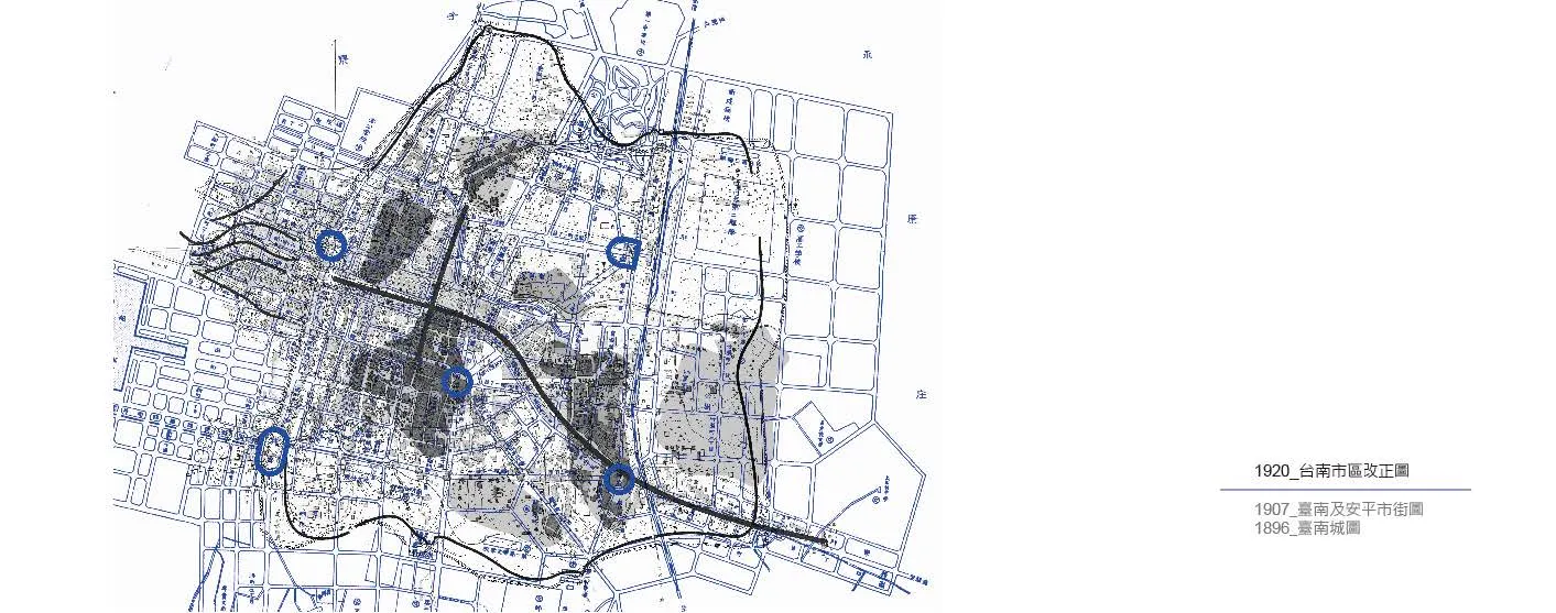
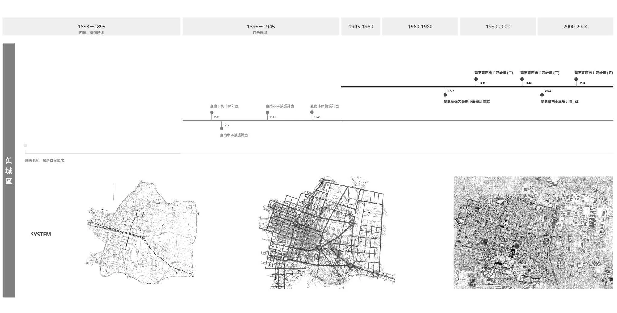
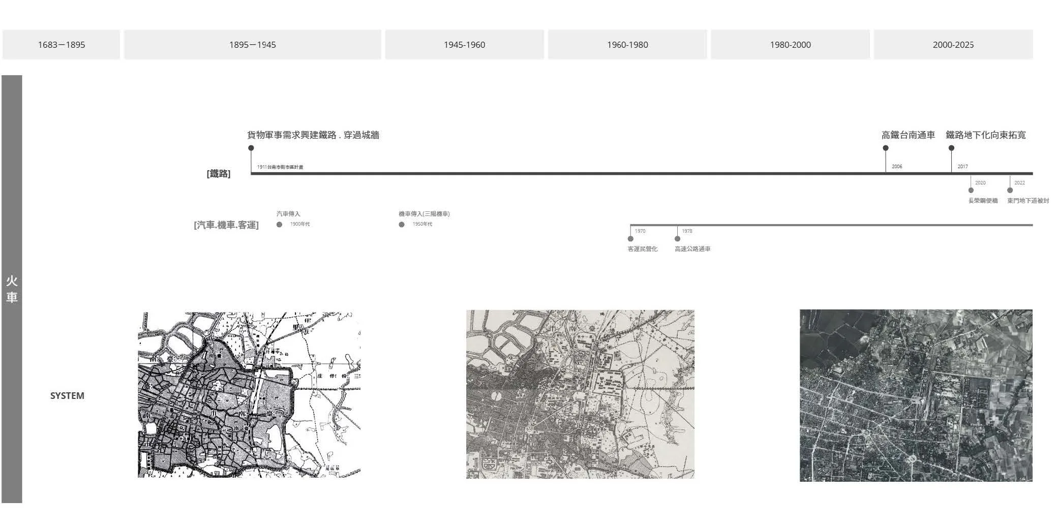
The History Context of Tainan City
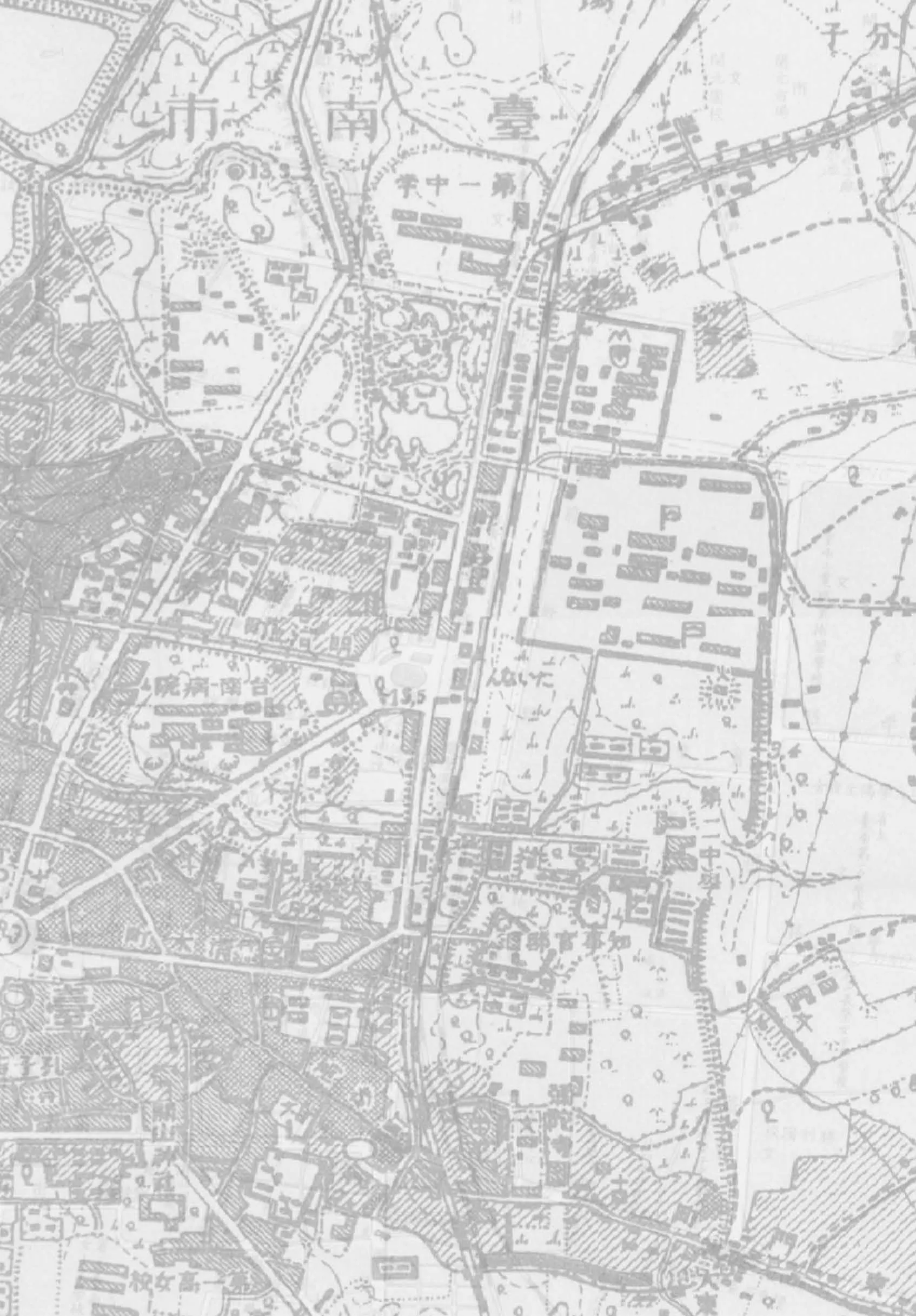
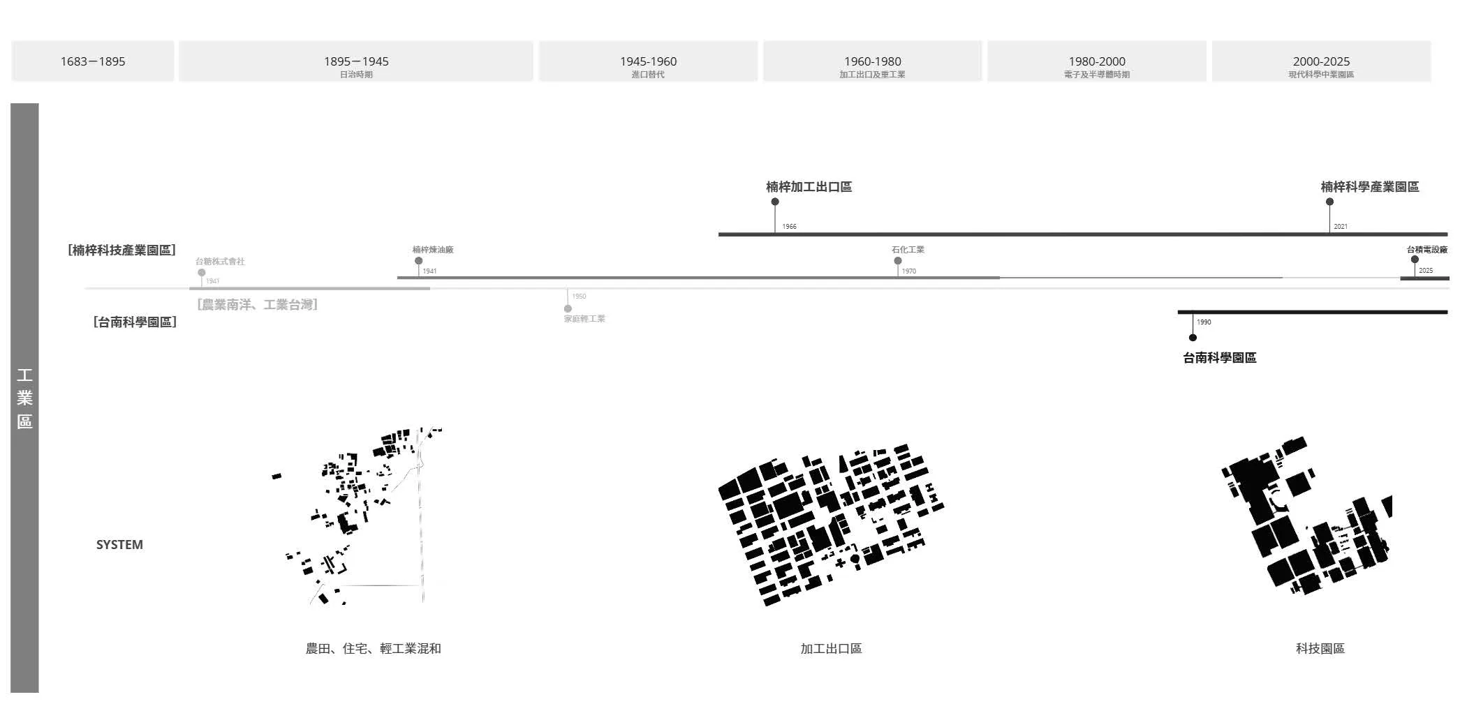
Taiwan’s urban development traces its roots from the Qing Dynasty’s initial cityscapes to modernization under Japanese colonial rule, marked by city planning projects. The 1911 Japanese plan introduced modern management concepts aimed at improving sanitation and city efficiency by reorganizing roads and streetscapes. After Taiwan’s transfer to the Republic of China, the island rapidly industrialized and modernized. The 1960s export processing zones and the 1980s Hsinchu Science Park were pivotal for economic growth. The 1970s Ten Major Constructions, including highways and railways, propelled regional development. Recently,railway undergrounding and eastward expansi on signal another phase of urban transformation.This historical trajectory reflects the multilayered influences shaping Taiwan’s urban evolution, from colonial rule to autonomous planning, culminating in its contemporary urban landscape.
 The History Context of Tainan City
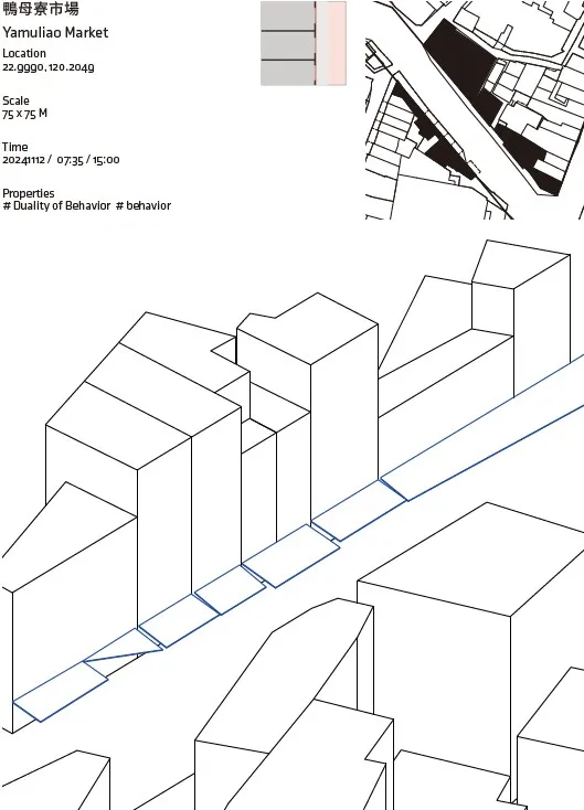
Classification: Grey Space Typology
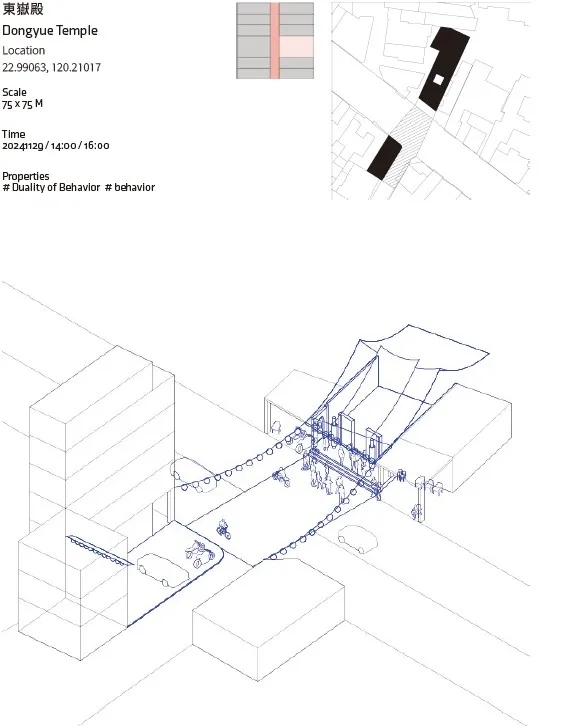
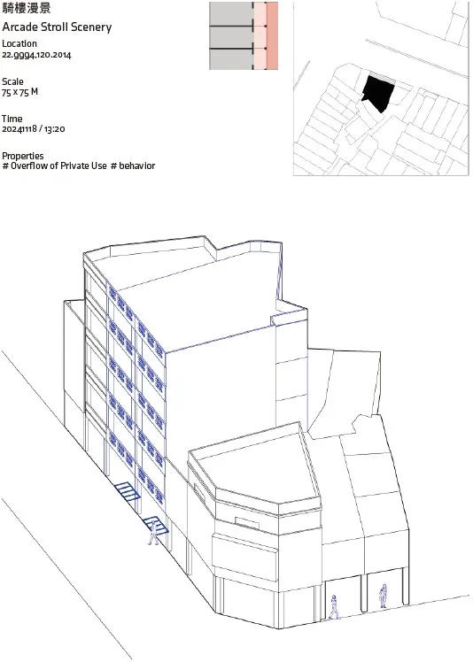
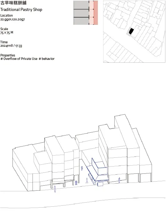
This study examines three representative spatial typologies in Tainan, showcasing grey space phenomena from small to large scales through location indexing for classification and analysis.It begins with the alleys of the old city, where spatial characteristics reveal a duality of behavior and the overflow of private use. Next, along the railway’s underground corridor, the spaces exhibit temporal gaps and land-use transitions, exposing disconnections in urban renewal processes.Finally, in the Tainan Science Park, the grey spaces emphasize contradictions between exclusive zoning and development rhythms within a highly planned environment.
These spatial phenomena are systematically analyzed across scales, from the dense texture of the old city to the expansive landscape of the science park. Together, they construct a grey map that transcends time and function, reflecting the tension and possibilities between policy planning and spatial autonomy during different stages of urban development.
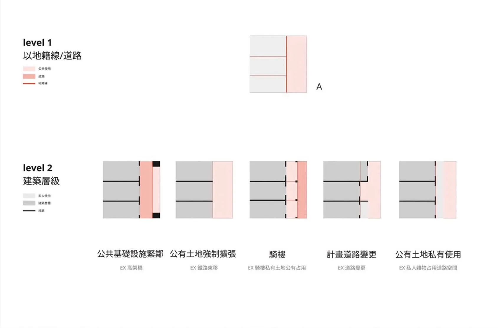
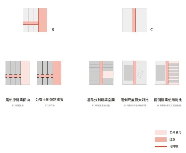
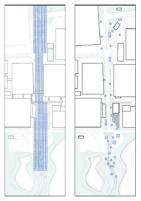
Analytical Approaches and Symbology
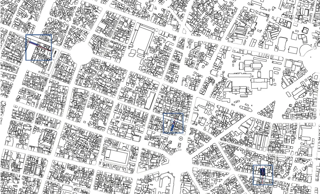
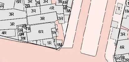
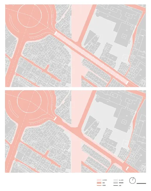
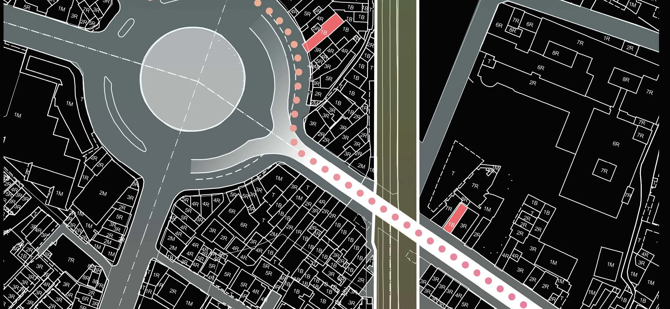
The phenomenon of grey spaces arises from the interplay between public and private uses of space,shaped by policy frameworks. Analyzing a specific site requires considering cadastral lines to identify ownership and examining activities indicators like road networks and building volumes.
In the accompanying diagrams, public spaces and roadways are shown in red, symbolizing topdown governmental policies, while grey represents individual responses. This dynamic illustrates the tensions between government policy and individual autonomy, highlighting the complexities of urban space management in Taiwan.
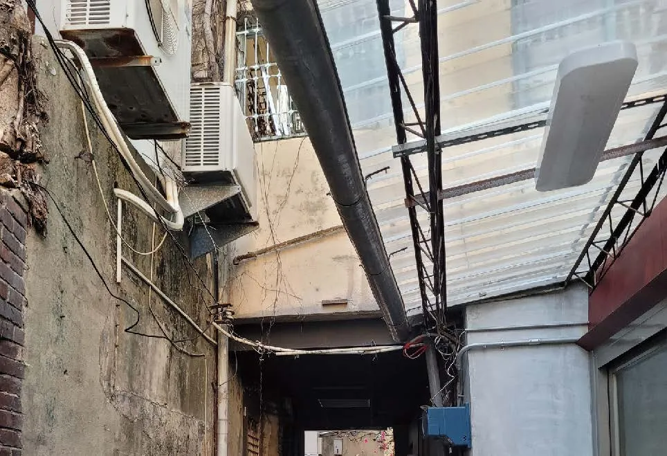
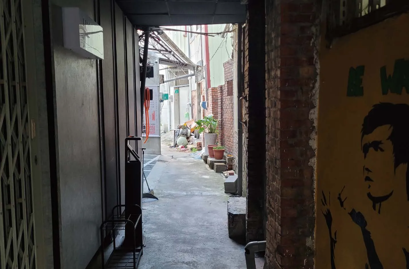
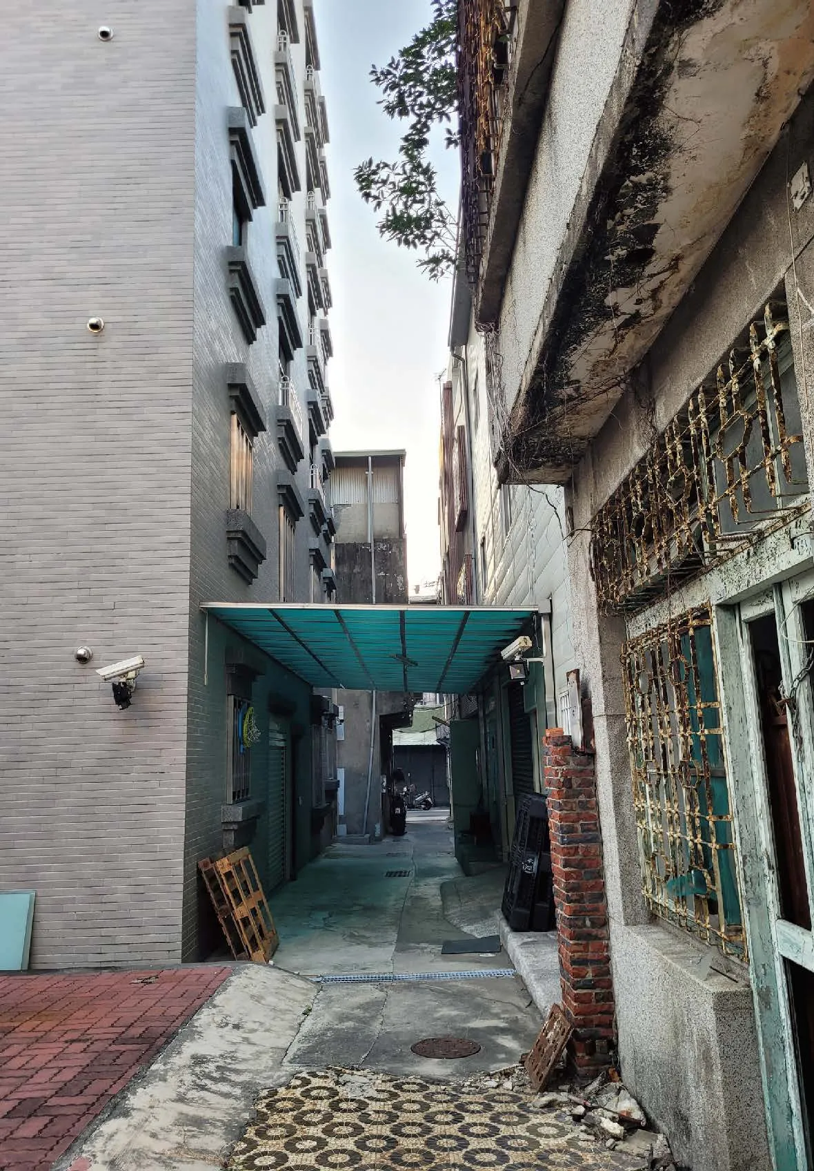
Site A: Downtown Tainan
Tainan’s history reaches back to the 1620s, making it Taiwan’s earliest developed city and the origin of the name “Taiwan.” Located in the island’s southwest, it is famed as Taiwan’s “cultural capital.” Its historic downtown—encompassing the walled city and the Wutiaogang area—covers about 315 hectares and contains the highest density of heritage sites.
While changing policies reshaped settlements and roads formed by natural terrain, local routines and cultural beliefs persist in alleys, arcades, and lanes.These “grey spaces,” bridging governance and daily life, define Tainan’s unique urban character.
During Ming–Qing times, the Chihkan area was the focal point, with Shizijie (now Minquan and Zhongyi Roads) extending west to Wutiaogang and east inland. Under Japanese rule, the 1911 city reform introduced ring and grid roads, framing the old city.In 1979, Tainan widened roads and expanded its plans to meet postwar population and economic growth—modernizing yet continually interweaving new areas and old in these “grey spaces.”
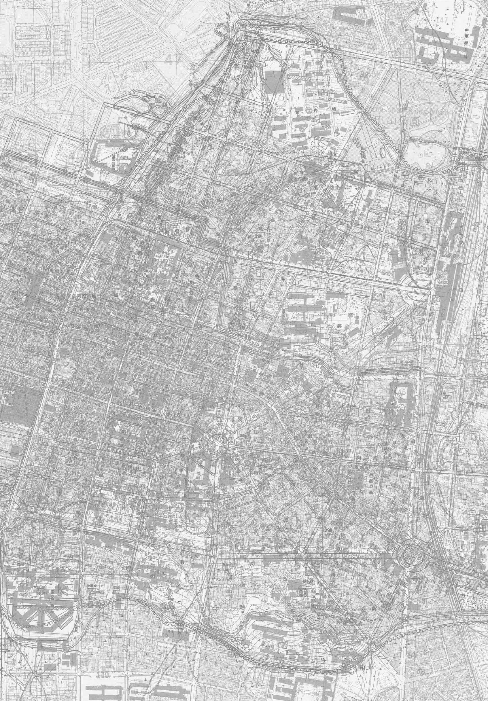


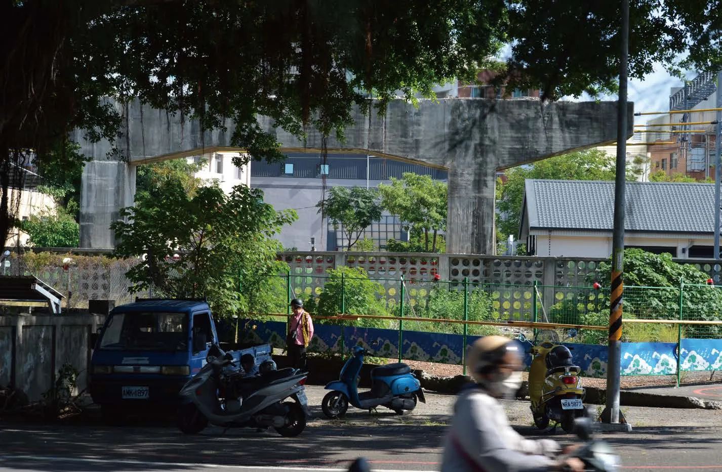
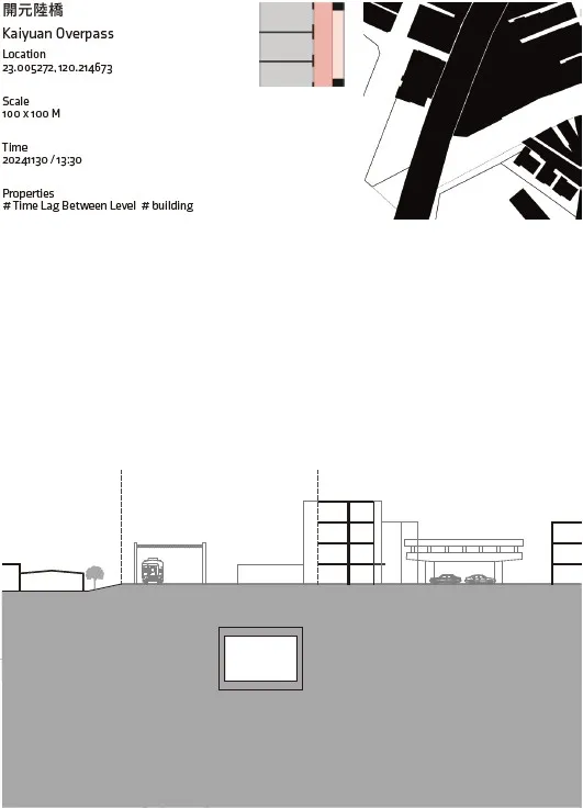
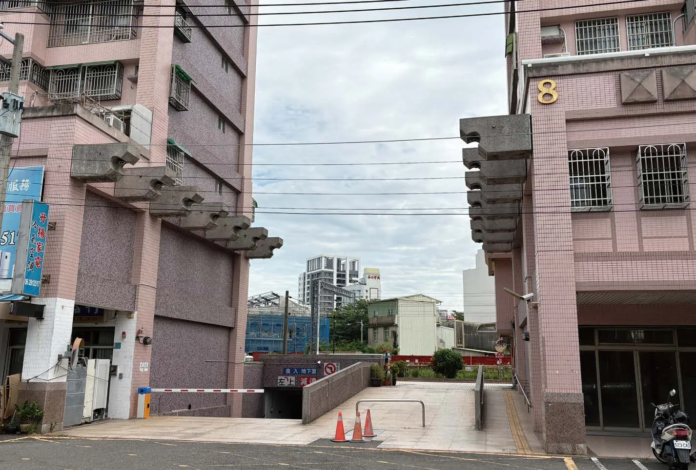
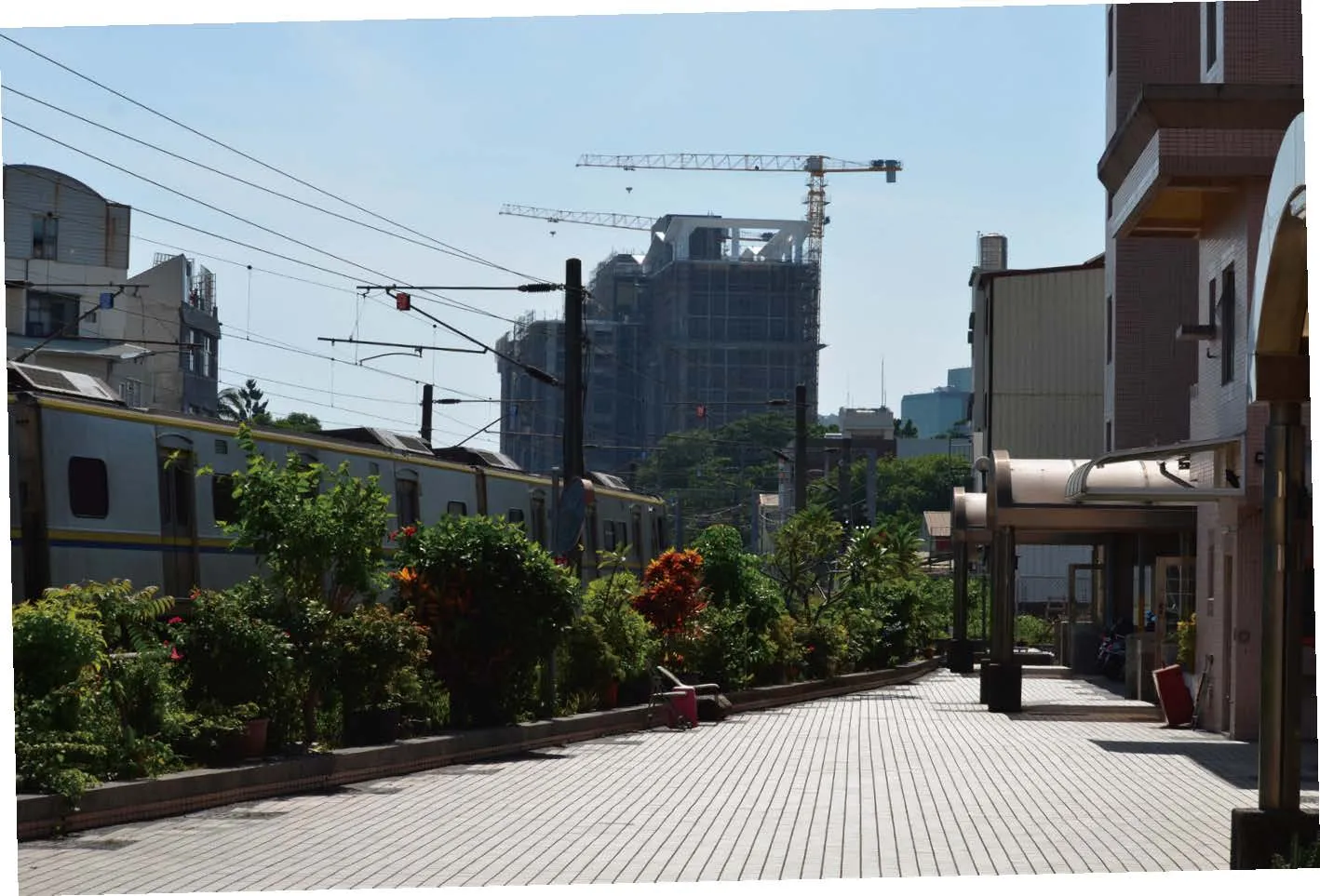
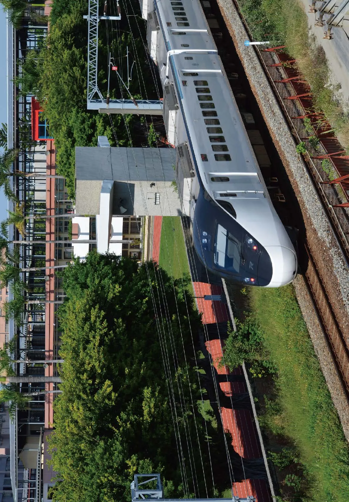
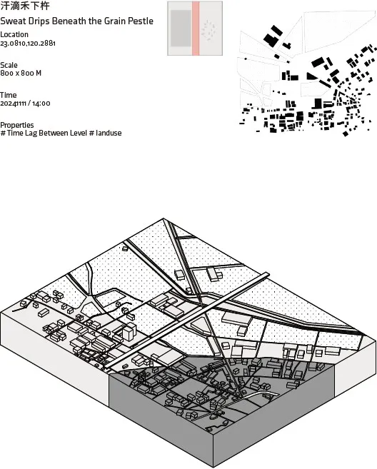
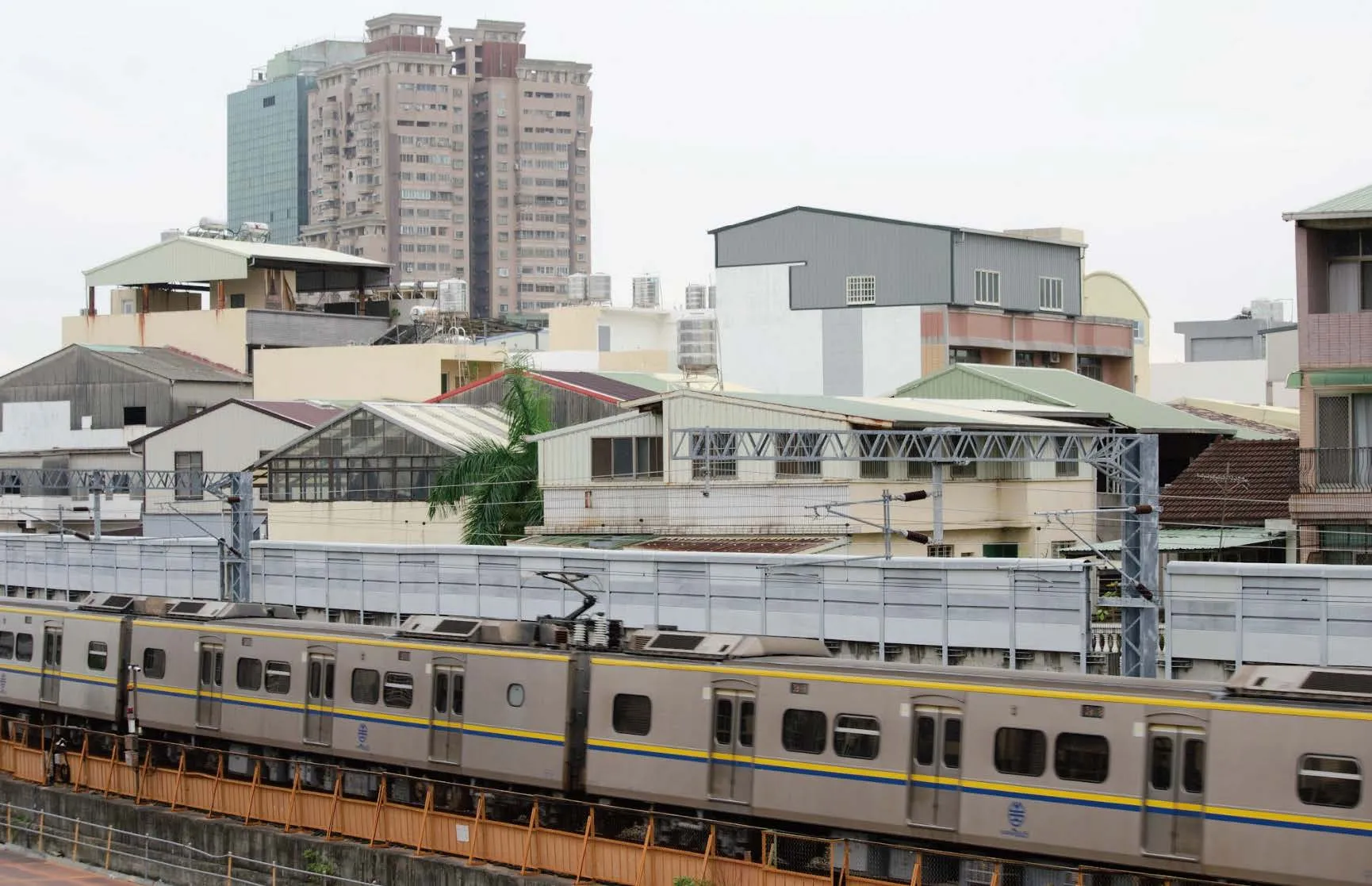
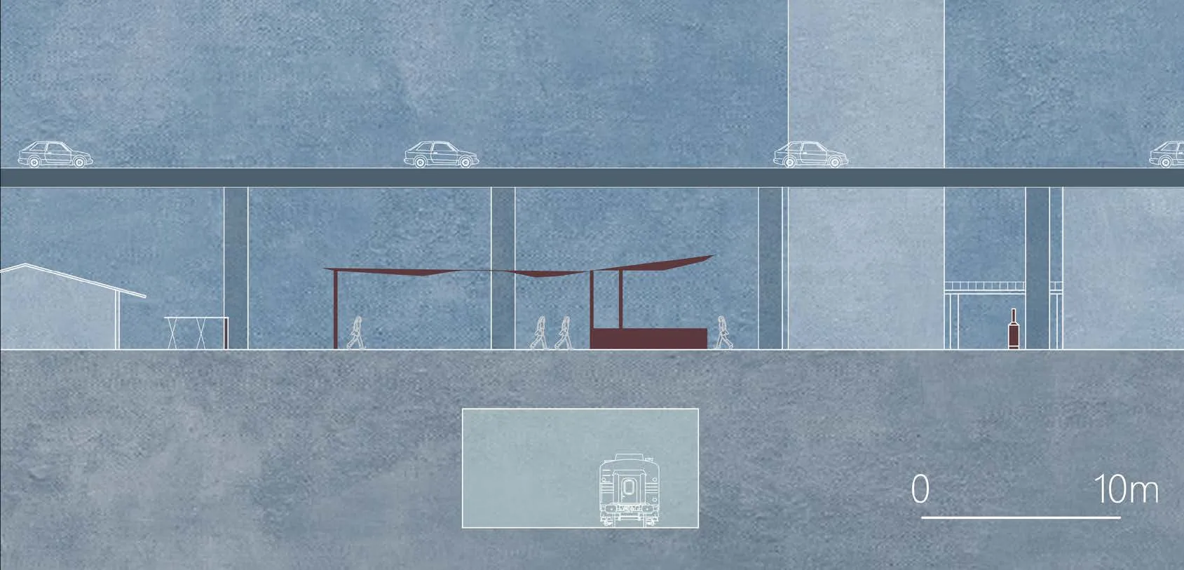
Site B: Railway Underground Project
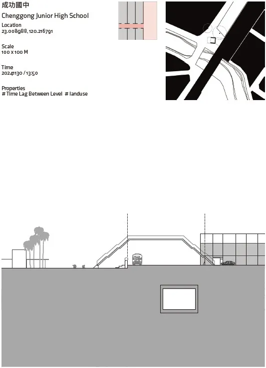
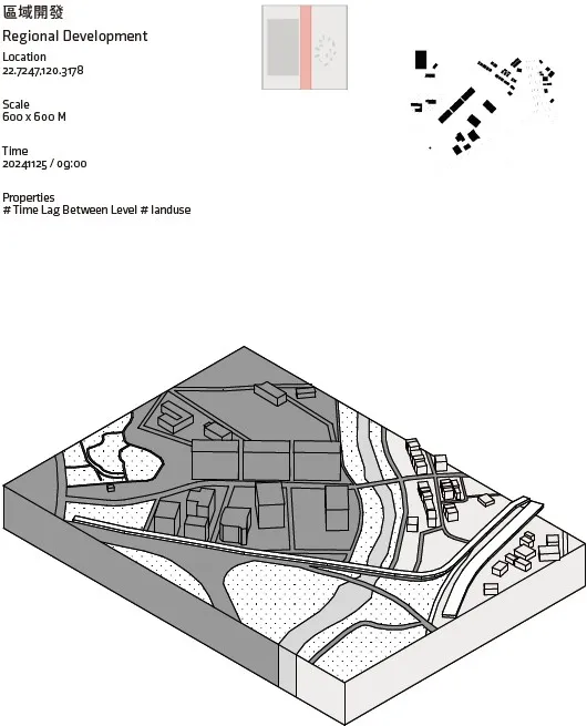
The Tainan Railway Underground Project has led to land expropriation east of the tracks, transforming once-enclosed railway property into open public space—an important shift in land-use policy since the Japanese colonial era. This change influences building orientation, elevated bridges, and underpasses, as well as how people inhabit these spaces, revealing how grassroots communities adapt under government-led initiatives. Focusing on the “time lag” in the undergrounding process,this study uncovers the reasons behind these transformations.
Initially established through top-down policies for freight and military purposes at the city’s edge, the railway later became integrated into residential zones as people expanded toward the tracks in a bottom-up, organic manner rather than through planned segregation. With the railway recently relocating eastward and heading underground,these once-sealed-off lands are now becoming open public areas. Each policy-driven phase redefines architectural forms and spatial usage,driving fresh adaptation and urban transitions.
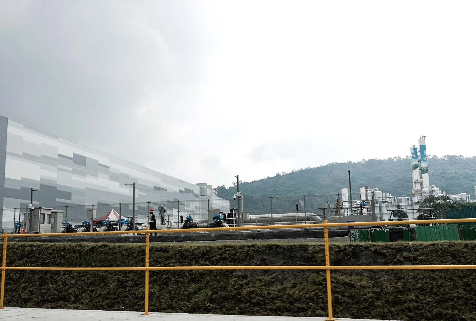
Site C: Southern Taiwan Science Park
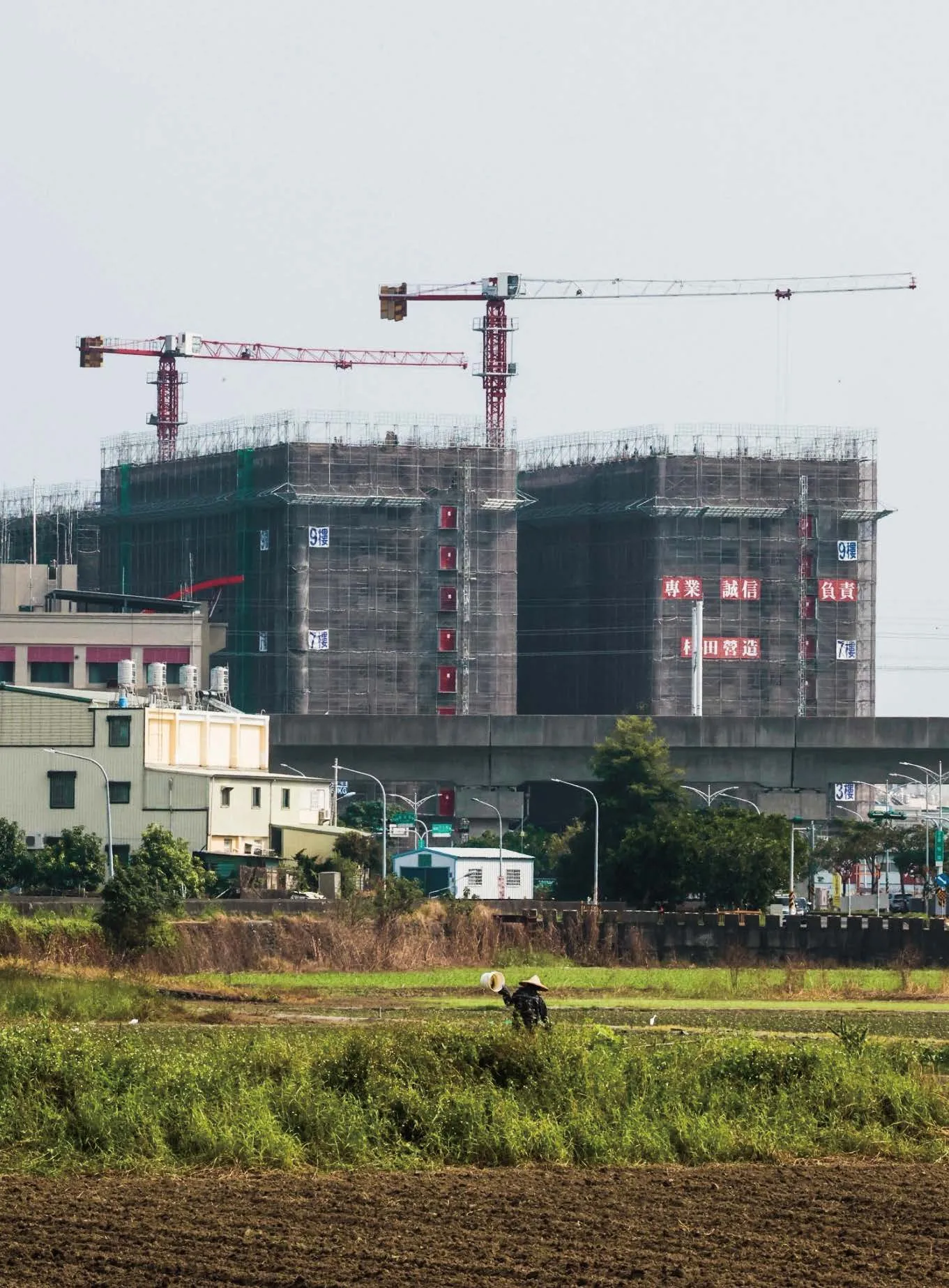
Established in 1995, the Southern Taiwan Science Park (STSP) marked a major step in advancing Taiwan’s high-tech industries. It initially repurposed 600 hectares of farmland into a comprehensive hub integrating factories, industrial estates, and residential zones, later expanding to 1,043 hectares.This area vividly contrasts modern industrial development with traditional villages, highlighting the effects of industrialization and urbanization.Daily photographic records capture this uneasy fusion—an emblem of the “grey zone” between technology and efficiency.

Design Proposals
This study endeavors to reevaluate the potential of architecture and urban design through the lens of grey spaces, thereby identifying innovative design values that emerge from the interplay of uncertainty and ambiguity.Tainan Railway Underground Project, the Old Town,and the Tainan Science Park as focal points, a series of eight design interventions are proposed that operate at varying scales. These interventions elucidate the intricate tension between public autonomy and governmental decision-making processes within urban environments. By integrating contemporary perspectives and interpretations into the historically layered urban landscape, this research aspires to uncover novel possibilities for the evolution of urban spaces.
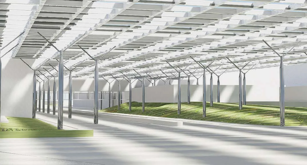
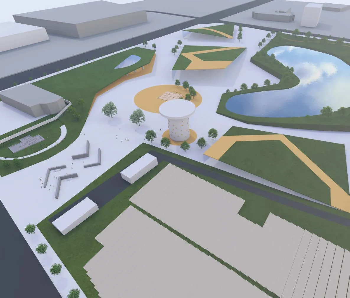
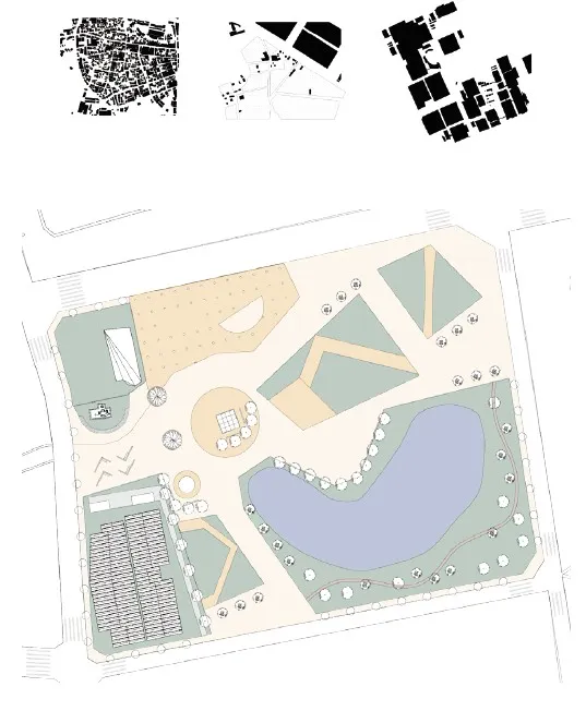
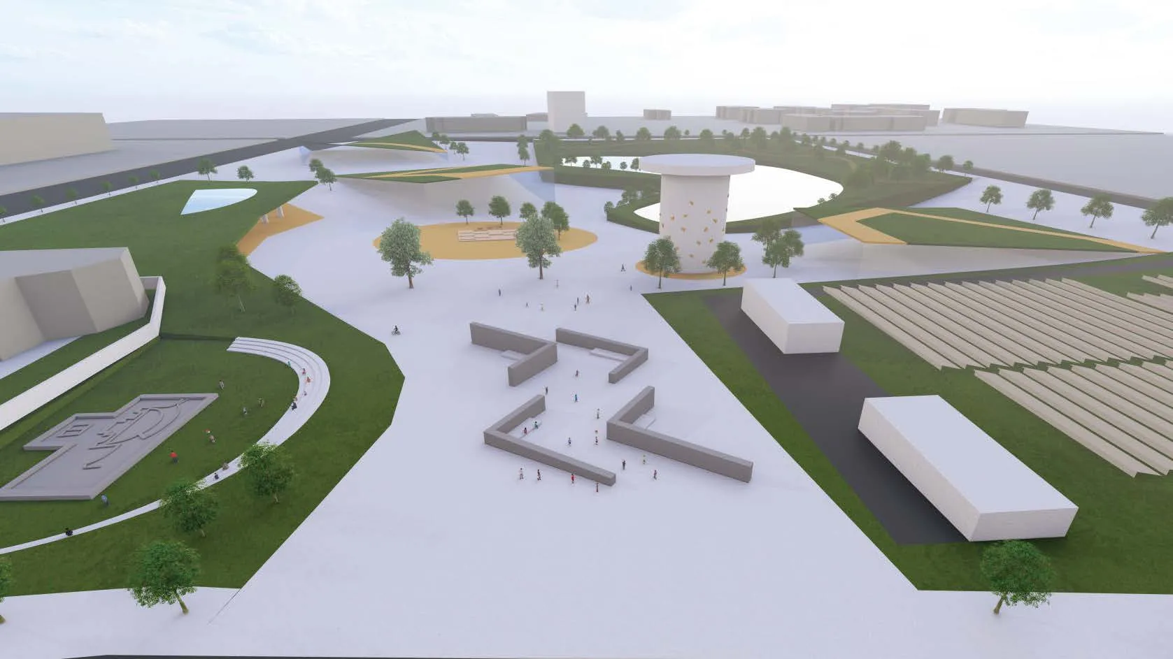
Transmission Landscape
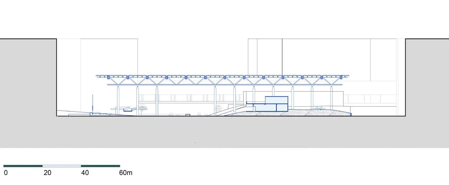
Site: Science Park Author: TIng-Chen, Wu
The design visions a transitional zone where industry and nature coexist through the extesion of space. Anchored by an 18-meter-high photovoltaic canopy, it transforms industrial voids into active human-centric spaces. The canopy is a porus intervention cutting thriugh the mega scale of the factory, generating energy while creating shaded for interaction and activity. Positioned between open roads and closed factory, grey space are udes to connect fragmented greenways and industrial corridors. This layered landscape fosters coexistence, redefines spatial hierarchies, and integrates human and ecological systems into a fluid, dynamic whole.
 The water surface covered by photovoltaic panels.
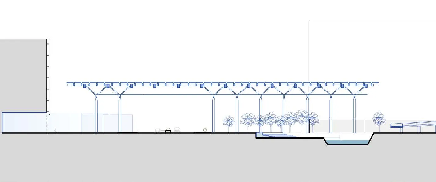 Natural context on the site.
 Extended activities under the canopy.
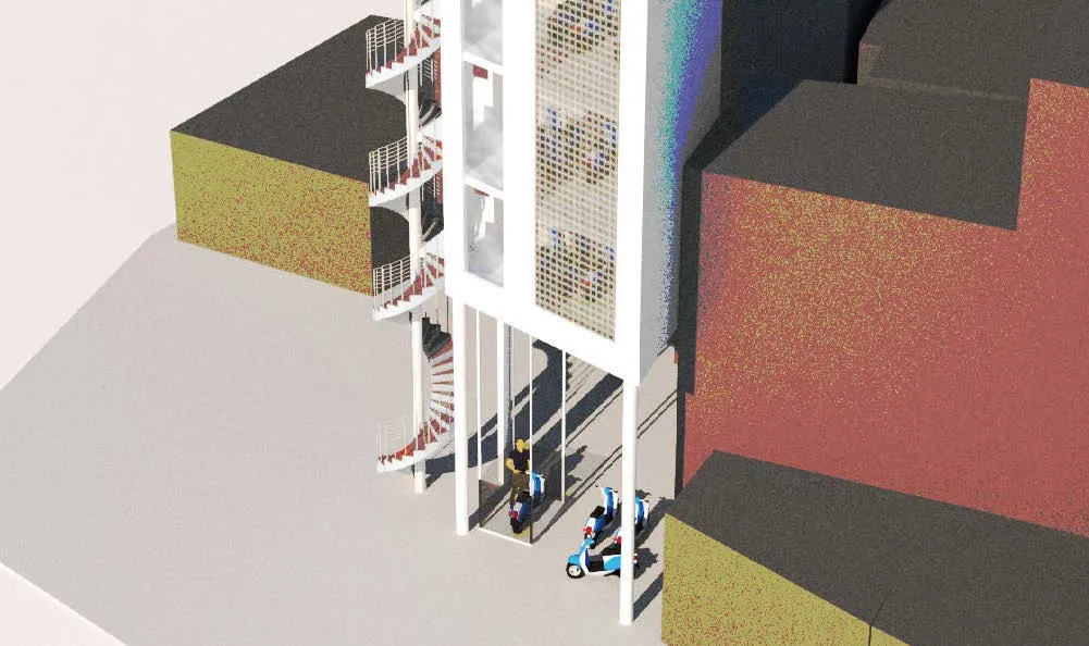
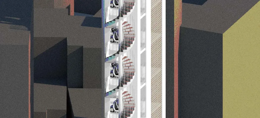
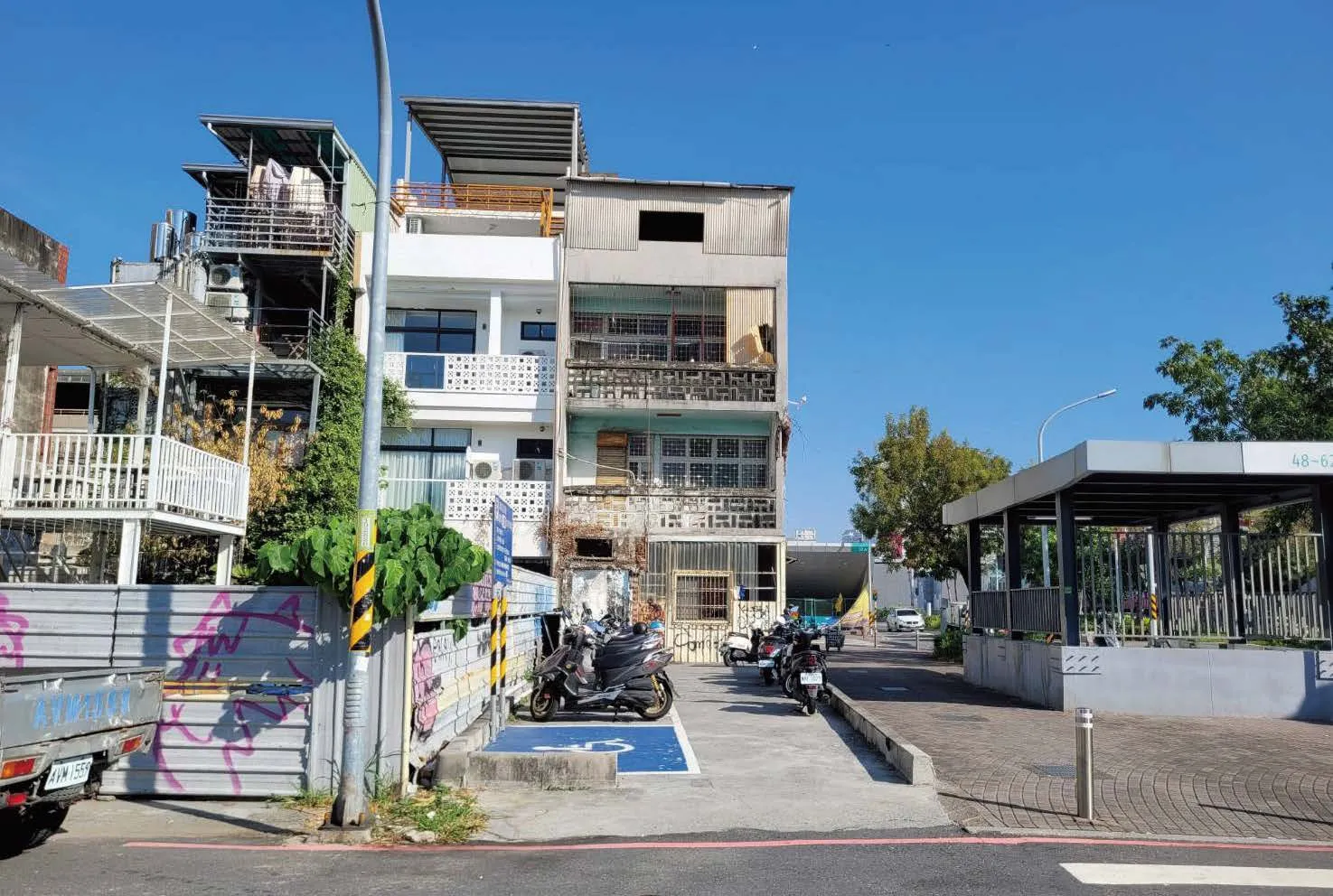
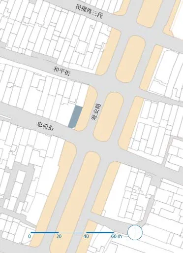
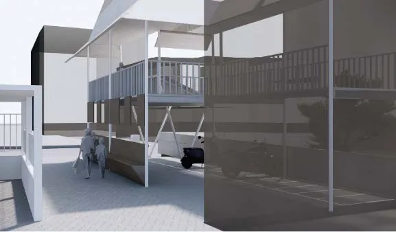
City Leftover Material Multi-storey motorcycle park
Site: Tainan Old City Author: Xiao-Pei, Chang
The old town area of Tainan has undergone numerous urban planning changes under different regimes. As a result, building plots have often been fragmented by road plans, creating many irregular and difficult-to-utilize plots. This project is located near the intersection of Hai’an Road and Zunwang Road, where the site is currently used as an open space for motorcycle parking.The design aims to maximize the functionality of motorcycle parking by creating a multi-level motorcycle parking facility.

Unearth the Fabric
Site: Science Park Author: Yen-Shan, Lee
The evolution of settlements begins with small objects that gradually form organic fabric. Around the Southern Taiwan Science Park, massive structures have emerged, creating distinct mega scale fabrics. As technological development drives the expansion of these patterns, the fabrics of old settlements are erased by time, leaving behind isolated objects: the ruins.
However, their inherent fabrics often remain hidden and disconnected from modern urban patterns. This study aims to highlight these forgotten temporal layers and reveal the “gray spaces” that bridge the past and present.


Co-Section Memories of road expansion in Tainan’s old urban areas
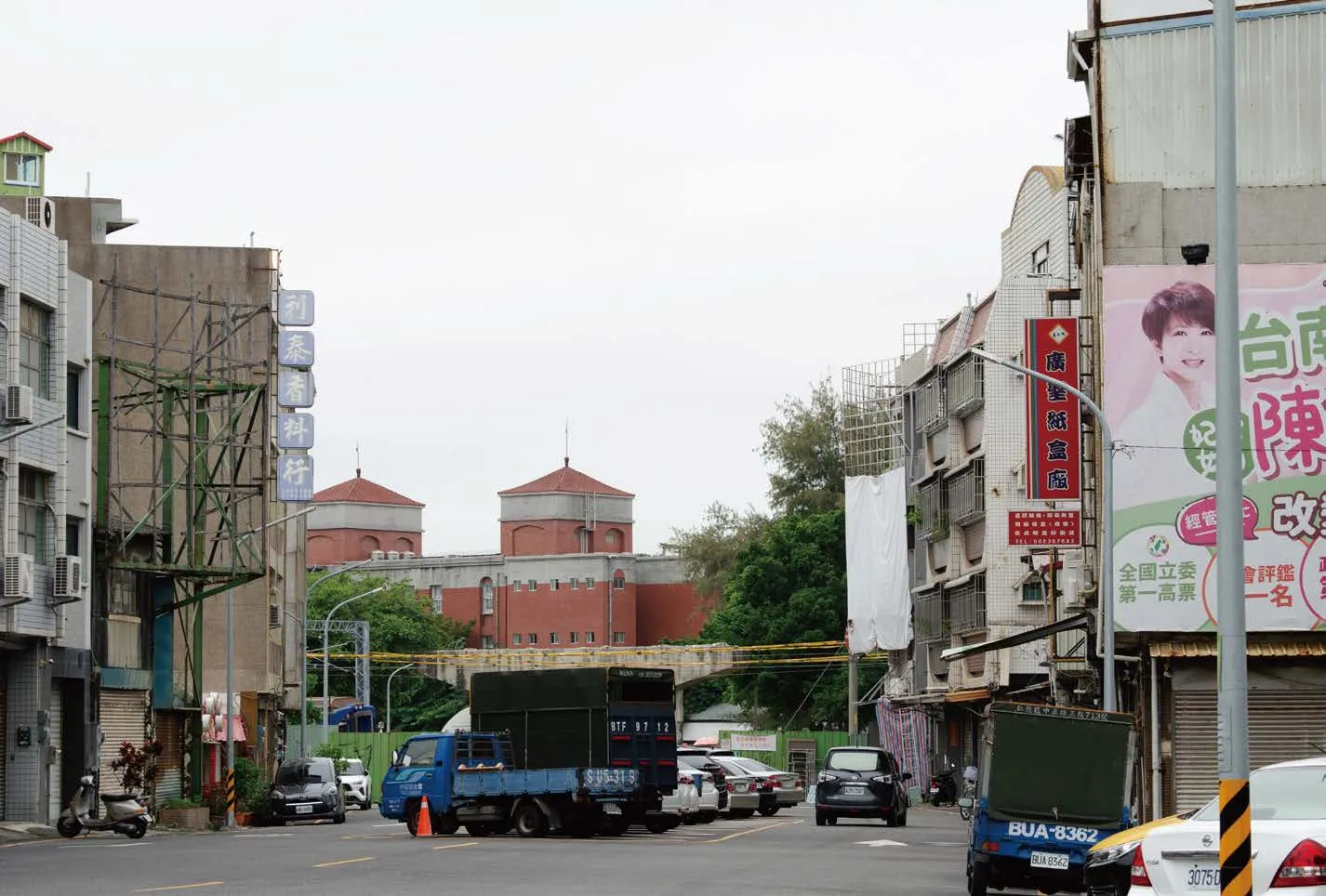
Site: Hai’an Road Author: Yi-Fang, Lai
The old city area of Tainan, a key hub since the Japanese colonial era, reflects layers of urban planning, from cross-shaped streets to redevelopment projects. Over time, these marks have blended into daily life. We’ve forgotten how buildings once fell to make way for wider roads or how the bustling commercial port vanished underground.On Hai’an Road, I aim to use a constructed form to tell the story of how space has transformed since the road’s widening. This project explores the gap between expectations and realities, examining its interactions with surrounding residences and user behaviors.


The ubiquitous wall From borders to boundaries
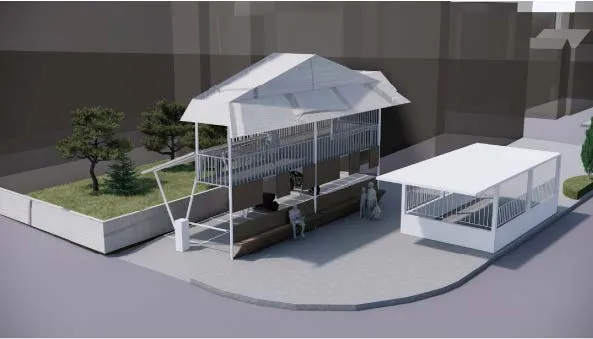
Site: Kaiyuan Elementary School Author: Yi-Hsien, Tseng
This design aims to explore the privacy and seclusion that the original railway once created for the surrounding community—an area that felt like the city’s hidden side. However, today, this oncetemporary border faces an uncertain future, and the way residents occupy the space has become increasingly passive. In the context of Tainan’s local character, I believe that what residents are more familiar with is not a rigid border, but rather a boundary defined by overlapping domains. People occupy this gray area based on usage and time, adapting it to their needs. The nature of this boundary is further shaped by the presence of two neighboring schools, shifting its publicness from a broader urban scale to a more community-oriented one. Children, the elderly, and working adults take turns claiming this space, transforming it into a shared territory that evolves throughout the day.
The Wall of the Residents or the Railway?
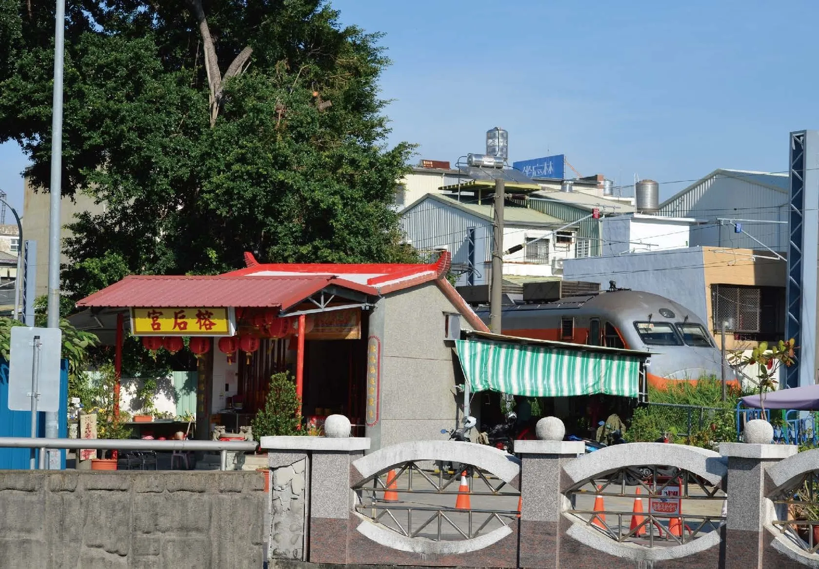
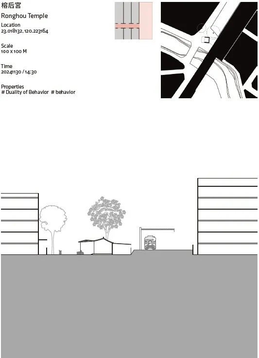
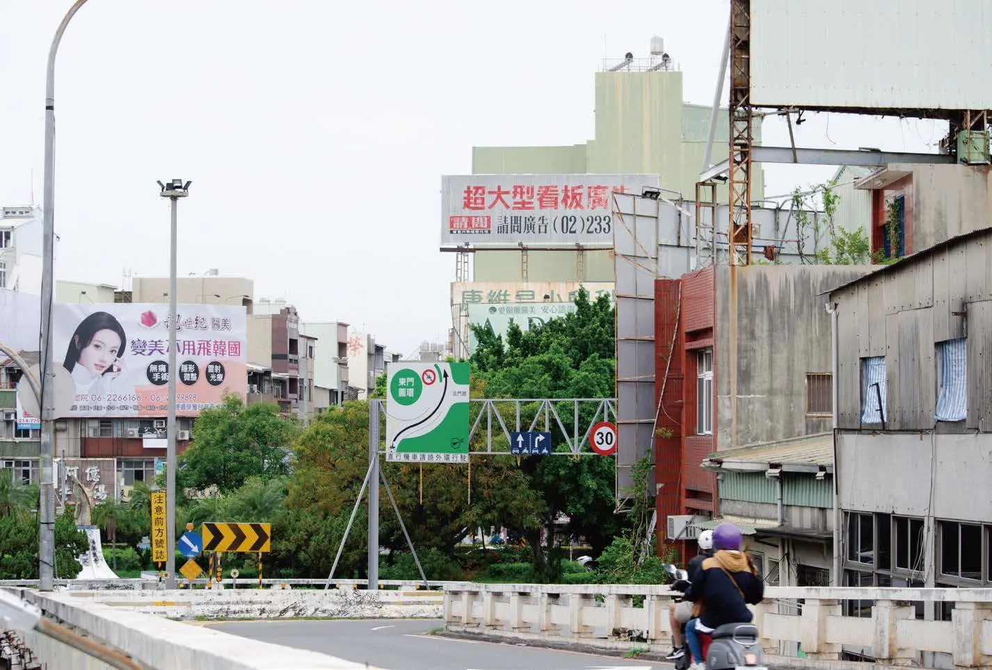
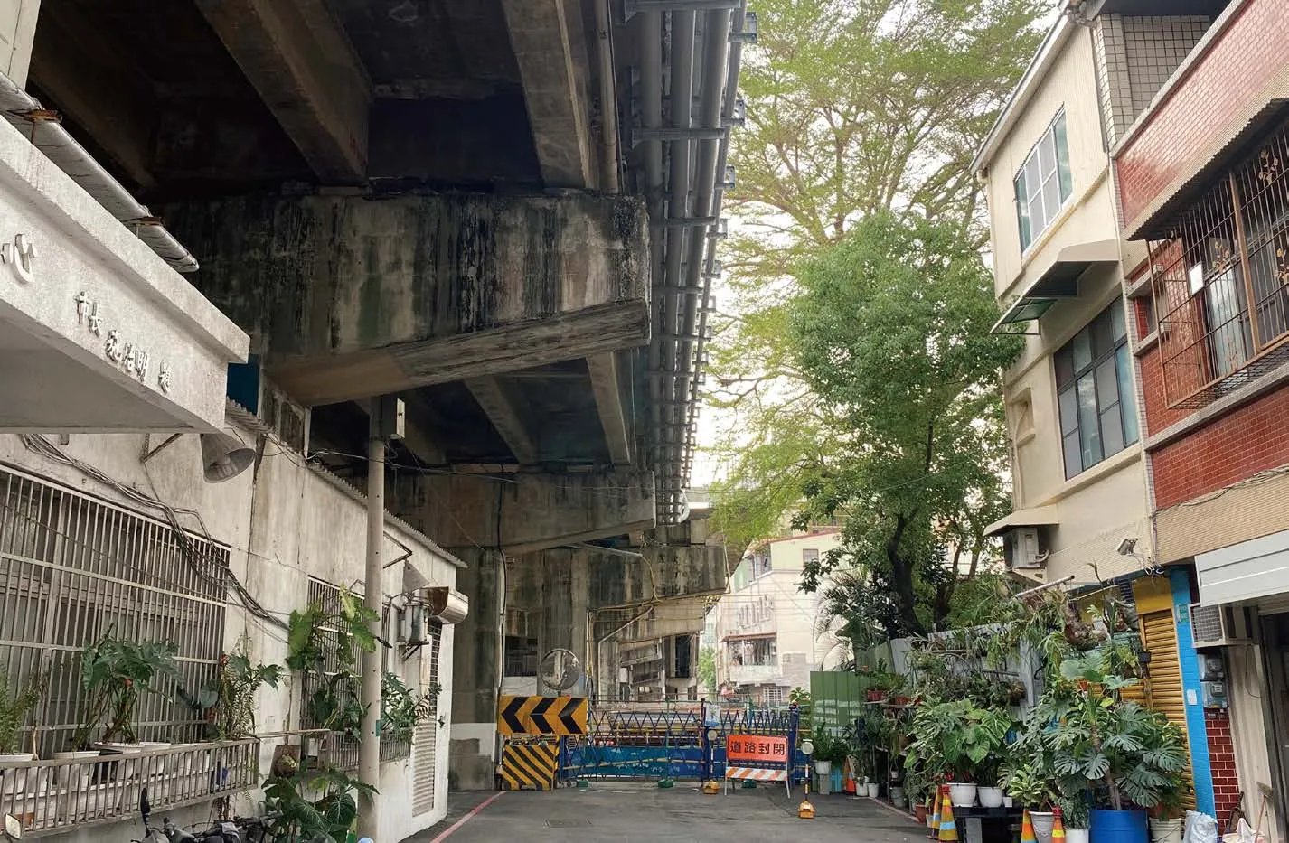
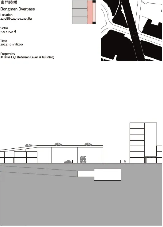
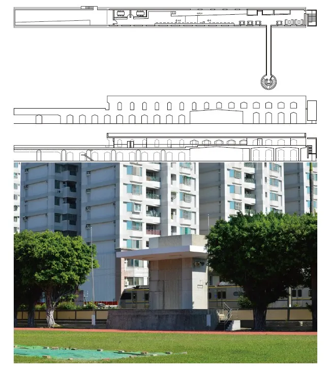
Site: Dongmen Overpass Author: Tsai-Yu, Huang
The undergrounding of railways not only requires residents to adjust to a new way of life, but also indirectly affects the urban space impacted by the elevated bridges, underpasses, and large transportation infrastructure built for the railway.The design site is chosen next to the railway near Dongmen Circle and the space beneath the Dongmen Overpass to explore the transformation of railway and urban-scale policies, as well as the interaction between temples, residential areas,and community-scale spaces. It focuses on how architecture responds to higher-level policies and how these elements can converse in design thinking.

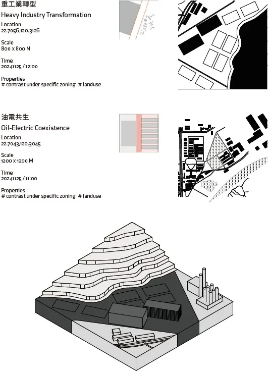
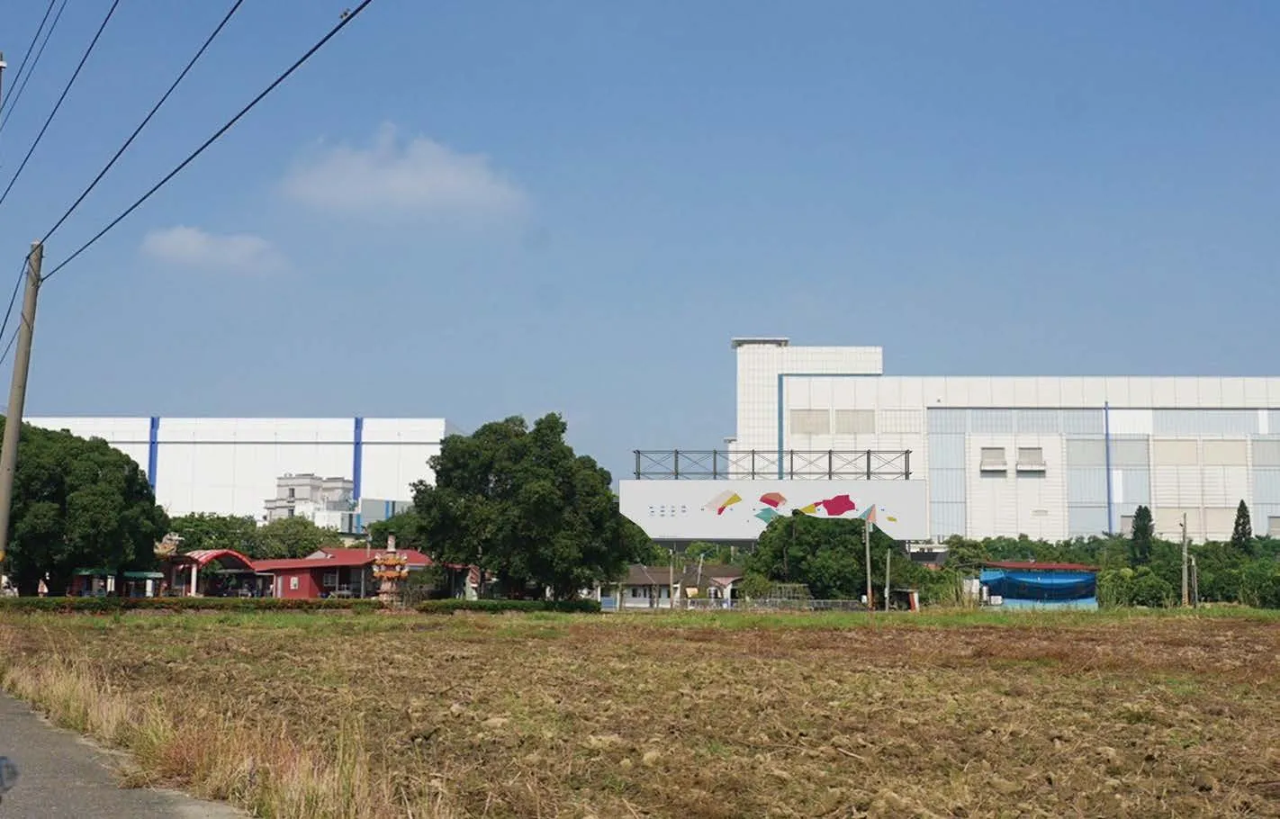
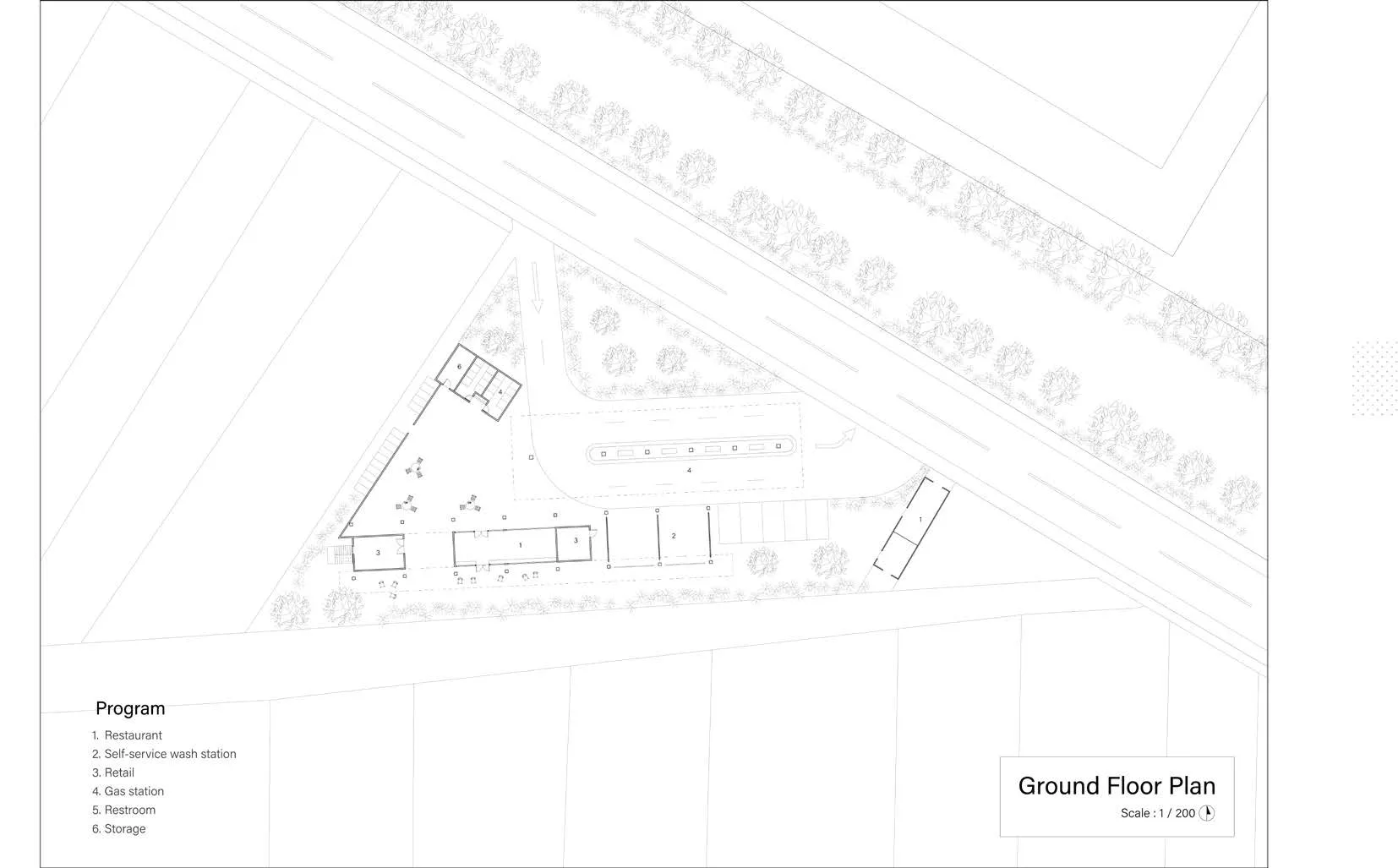
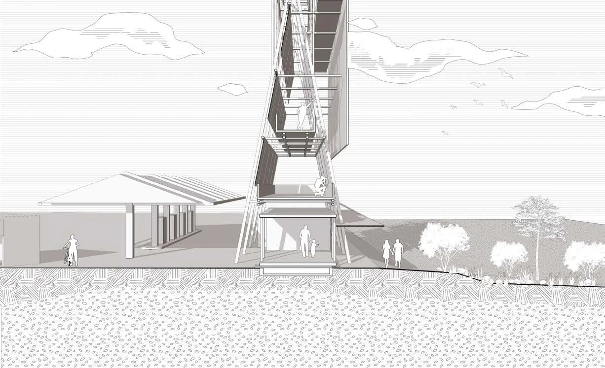
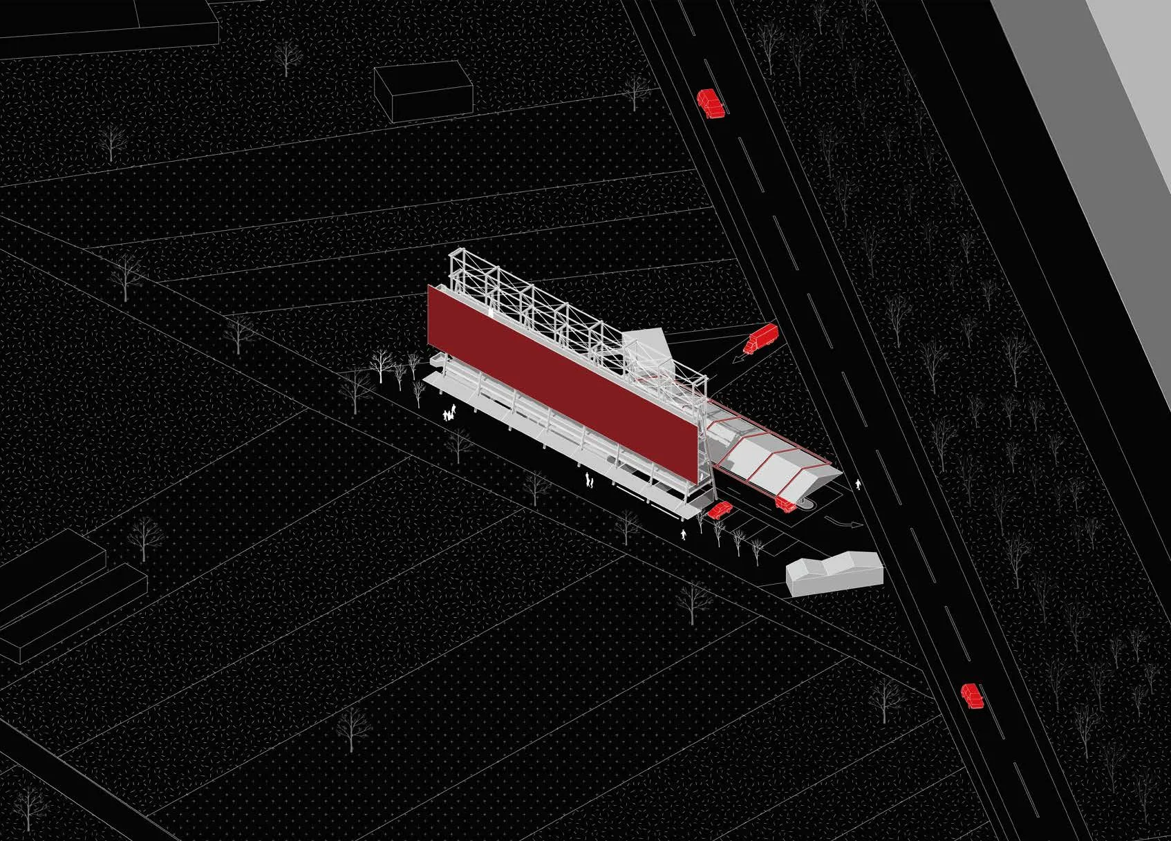
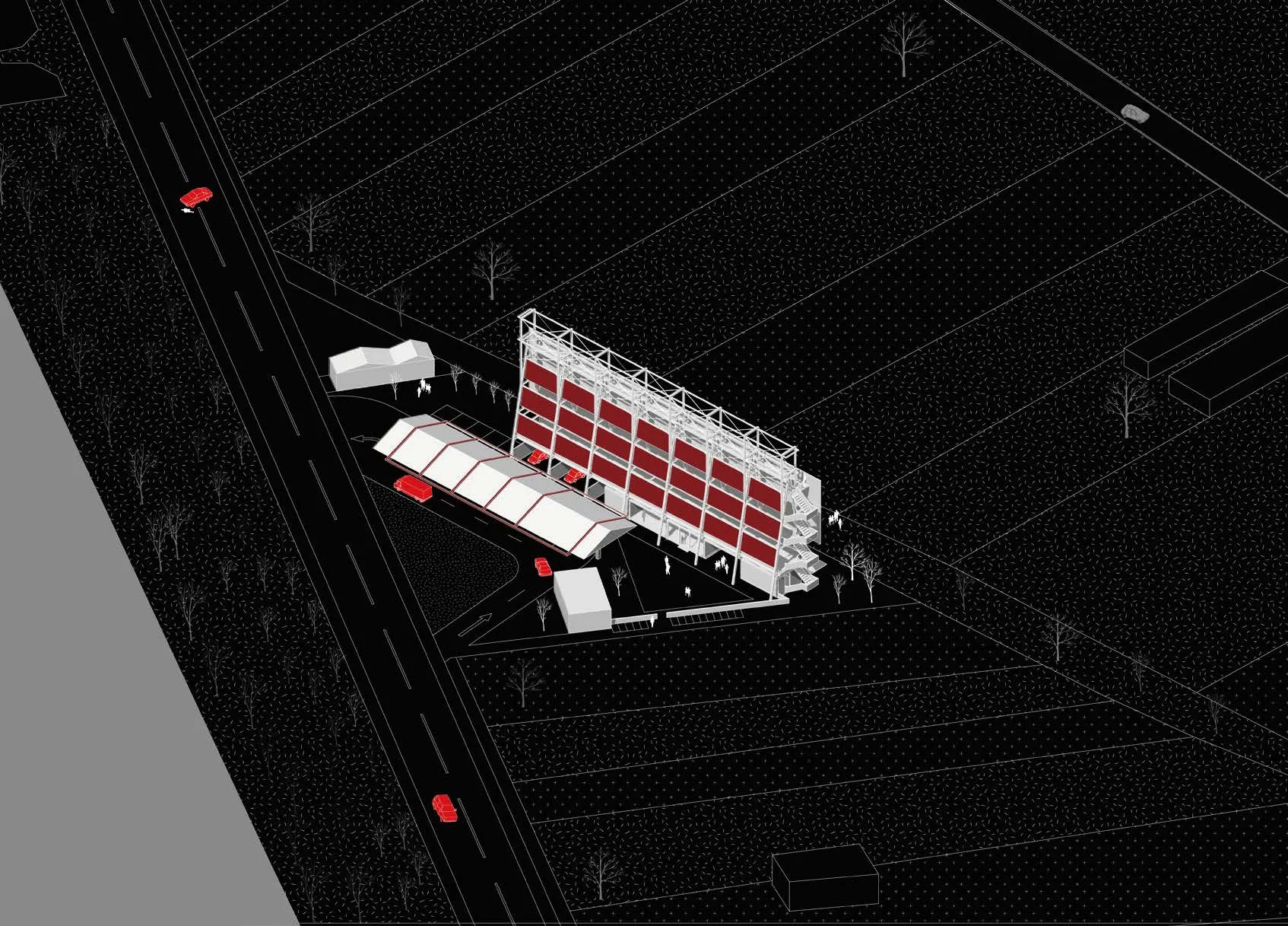
Between Contrasts Bridging the Tradition and Technology in Nanke
Site: Nanke Author: Po-Yuan, Su
Nanke’s landscape showcases stark contrasts between traditional farmland and a high-tech science park, highlighting the division between rural and urban lives.Located on a triangular site along a key commuting route, the design utilizes an advertising scaffold as a spatial framework, integrating a gas station,car wash, and local eatery to create a shared space.By blending rural and industrial aesthetics, the development encourages interaction, redefines daily routines, and blurs boundaries, offering insights into Nanke’s evolving socio-spatial dynamics.
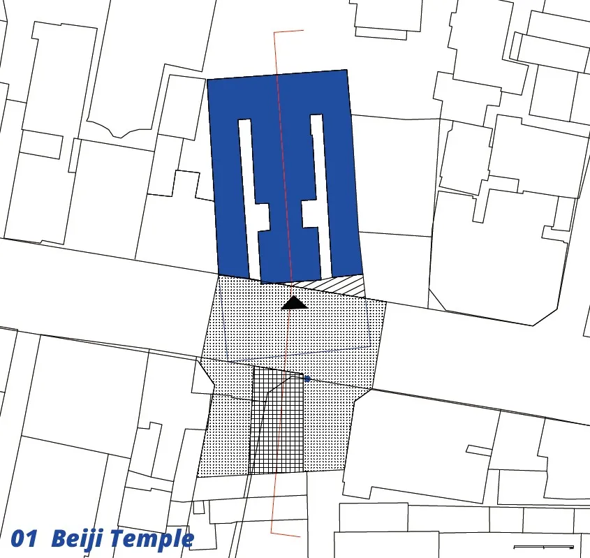
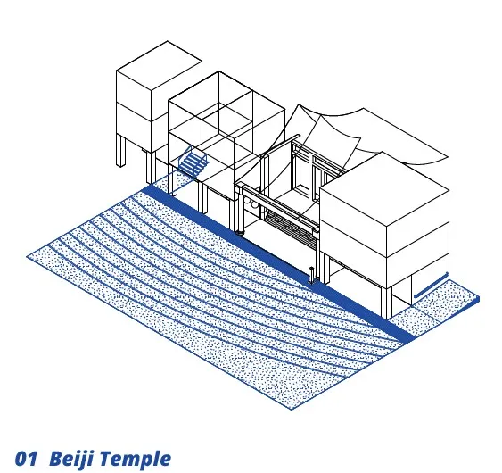
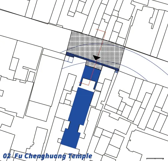
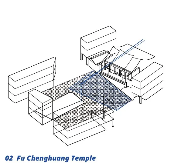
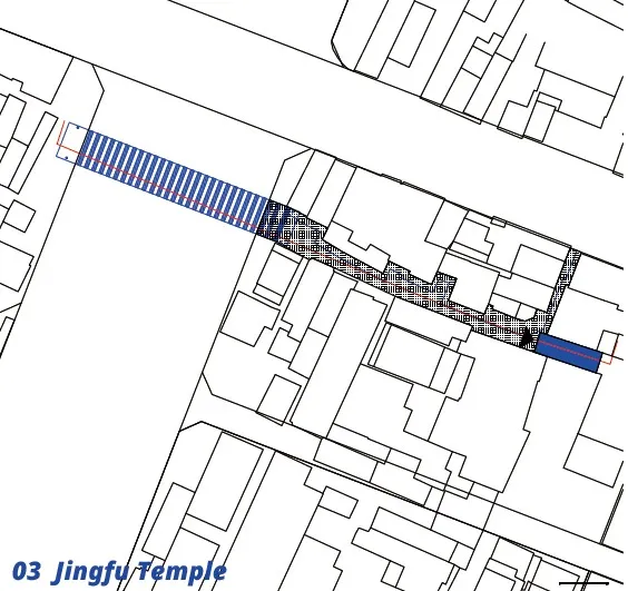
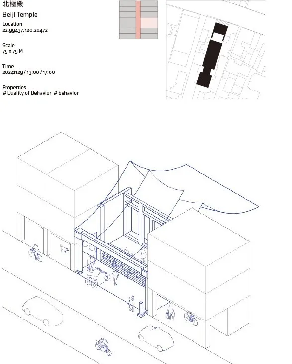
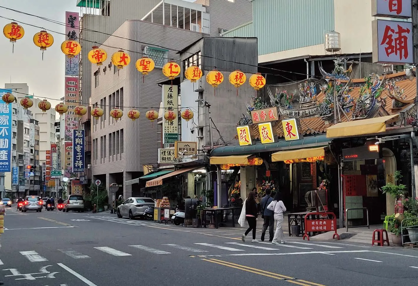
From Borders to Boundaries Reinterpreting the Layers of Urban and Religious Spaces
Site: Old Town District Author: Jasmine, Kuo
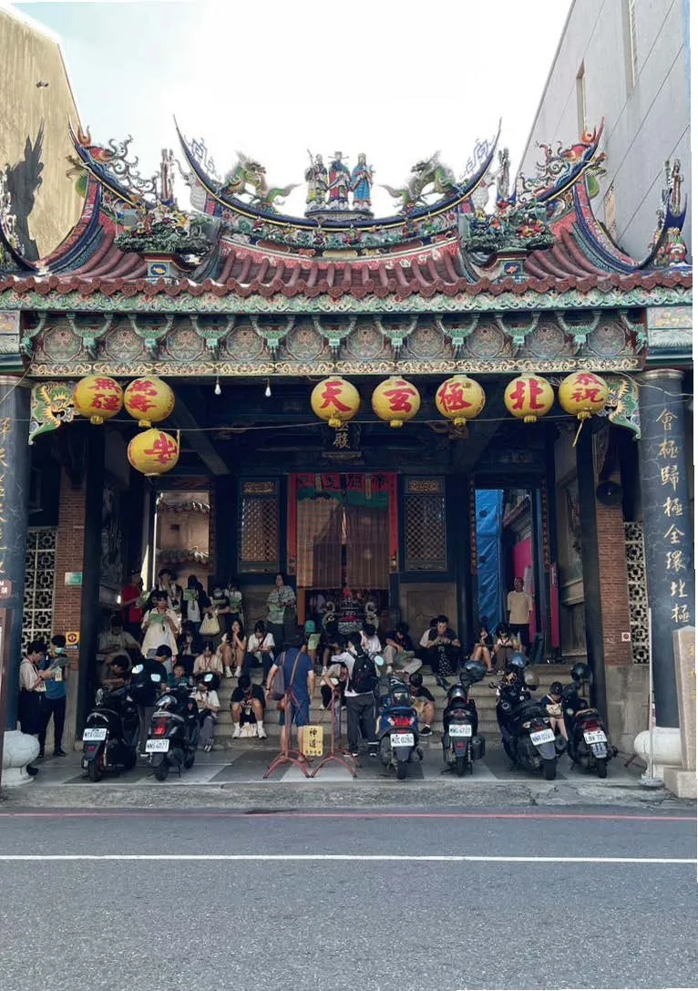
The gray spaces around old town temples blur public and private boundaries due to urban changes.From the Ming and Qing periods to the Japanese colonial era and postwar road expansions, these spaces evolved, serving daily functions like traffic and commerce, while transforming into religious sites during festivals. My design aims to clarify these historical narratives and spatial functions.At Beiji Temple, stairways and slopes emphasize natural contours, while at Fu Chenghuang Temple,ground textures reveal the hidden courtyard’s boundaries. At Jingfu temple, a lattice canopy and guiding light lead visitors, with overhead lines transforming daily commerce into a symbolic ritual.