Liminal Void: Insurgent Ecologies of the Ruderal Landscape
#commonality #liminal #wildness
Exhitbitor
Meng-Tsun SU,
Pin-Yi HO
Exhibition Team
Tunghai University Department of Architecture
Team Member
Hao-Yuan CHIANG,
Che-Lun LEE
View the Printed Edition (PDF)
Introduction
Drawing a diagonal line across the plains of Taiwan’s western coast, weaving between highways and shifting distances from the shoreline,reveals fragmented, marginal, and incidental landscapes shaped by diverse geomorphological conditions. Over time, urban contraction and expansion are part of economic and ecological cycles—imagining growth in contraction and contraction in prosperity. The concept of the ruderal landscape explores no-man’s lands, highlighting species and social diversity. These seemingly fragmented spaces become opportunities for cross-species commonality, blurring the distinction between the ordinary and the shared commons.
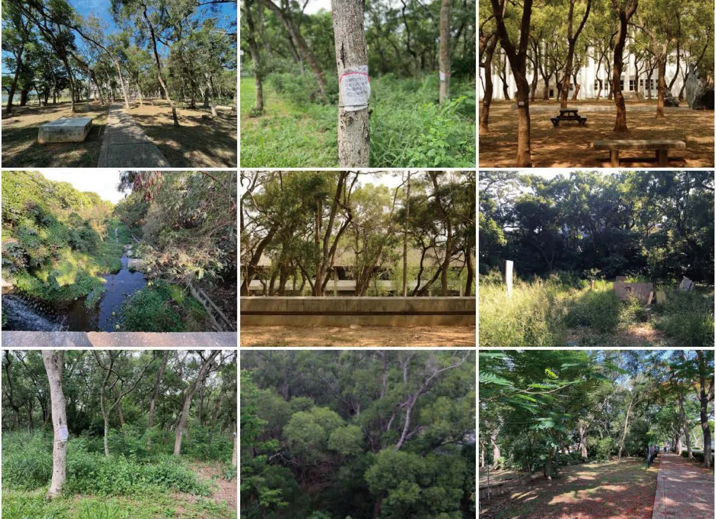
Confronting familiar yet subtly dissonant wastelands and vacant spaces, we identify “liminal voids”—threshold spaces that evoke psychological shifts. Rather than a concrete design proposal, this project focuses on recognizing, naming, and observing various intermediary landscapes between urban and rural contexts. By enhancing their legibility, we aim to articulate their implicit yet vital significance.The six sampled sites—Dadu Terrace, Hanshi River Basin, Chenglong and Yiwu Wetland, Shimei Community, Sounthern Taiwan Science Campus—are informal spaces beyond conventional governance. These palimpsest landscapes, shaped by erasure, rewriting, and occupation, accumulate new layers over time, forming bricolage ecologies.
Canadian ecologist Nina-Marie Lister views “initiating resilience” as a curatorial act,emphasizing that landscape infrastructure research must be contextual, legible, nuanced,and responsive—though small in scale, its cumulative impact can be profound. Both organic and inorganic elements significantly shape biological forms, as organisms are forced to adapt to their environments. In post-industrial Taiwan,where manufacturing declines and tourism and service industries rise, shifting modes of collective production affect daily life, manifesting in intermediary landscapes between urban and rural spaces, where economic and ecological forces intersect.
From abandoned woodlands to forested lands,farmlands, and vacant lots, these urban edge landscapes in Taiwan emerge from contingencies of law, economy, and ownership. As cities and rural areas form interconnected networks,recognizing the connective role of wastelands and vacant spaces shifts them from the periphery of discourse and governance to central hubs. Their non-programmed use becomes a meaningful cultural occupation, fostering socio-ecological entanglements. Over a century, urban expansion and contraction remain part of economic and ecological cycles, turning fragmented landscapes into opportunities for commonality—the foundation of everyday democratic spaces.
#palimpsest
A palimpsest landscape where traces of both erasure and rewriting overlap, revealing layers of old and new.
#ruderal ecology
A spontaneous landscape where native and nonnative species coexist.
#occupation
After human intervention or natural disturbances,new users take over vacant spaces, triggering new forms of commonality.
#bricolage
A composite system formed through makeshift assemblage, beyond governance focused on efficiency and speed.
#socio-ecological entanglement
The interwoven relationship of scientific forestry,military industry, and capitalism reveals the hybrid nature of development, consumption, and conservation.
#urban forestry
The integration of ecological forest management into urban landscapes, creating low-cost, selfsustaining environments through mixed-species reforestation.
#rewilding
Alain Weisman, in The World Without Us,suggests that in a world “without us,” cities would quickly vanish while surviving life would rapidly evolve. These fragmented landscapes,though unclassifiable, share a common trait—high biodiversity. Left undisturbed, they undergo natural ecological succession, progressing from pioneer species to climax communities,increasing biodiversity and stability until the next disturbance.
#third landscape
Proposed by French landscape architect Gilles Clément, the Third Landscape is neither controlled nor neglected but mimics nature’s selfregulation.Unlike government-managed parks,it exists between governance and wild reserves,embodying areas beyond structured control.
#non-programmed use
Emerging in late 20th-century urban design,this concept responds to the decline of essential public life, replaced by passive, optional urban leisure. It advocates for initiating and curating flexible public spaces that adapt to evolving social needs.
#centrality
Wild urbanism does not remain on the outskirts;once weeds break free from abandoned spaces,they must occupy the city’s most prominent locations. Untamed nature steps into the foreground, embodying both the order and chaos of the jungle, merging the aesthetics of the sublime with the ethics of scientific knowledge.
#commonality
Public space as a shared environment where common sense and consensus shape its social meaning.
#liminal space
Ordinary landscapes create continuity through familiarity, yet subtle distortions or dissonance provoke estrangement, challenging everyday perceptions.
#wildness
Distinguishing between wildness (a concept)and wilderness (a designated space), the former refers to spontaneous, uncultivated growth, often shaped by cultural imagination.
#hedgerow
Hedgerow marks the boundaries of farmland.After World War II, land redistribution policies introduced new private property divisions,transforming open fields into narrow,segmented plots. Beyond providing shade and shelter, hedgerows serve as refuges for farmland biodiversity, acting as ecotones within agricultural ecosystems.
Site Samplings
Site 1 - Shifting Landscape of Dadu Terrace, Taichung Site 2 - Hanshi River Basin Riparian Area, Taichung Site 3 - Multifaceted Wetlands of Chenglong Wetland, Yunlin Site 4 - The Significance of the Provisional at Yiwu Wetland, Yunlin Site 5 - Where River Bends: Shimei’s Sugar Industrial Landscape, Tainan Site 6 - Ecotones at Sounthern Taiwan Science Campus, Tainan

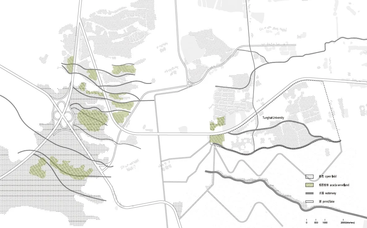
Site Sampling #1 Shifting Landscape of Dadu Terrace, Taichung
Dadu Mountain, resembling a protruding abdomen,is a north-south hilly terrain formed by river-borne gravel deposits, which gave rise to its historical name, Dadu—literally meaning “big balley.” Its ridgeline, along with the Baguashan Mountain to the south, creates a strategic vantage point for military observation, reconnaissance, and defense.From coastal settlements along the Taiwan Railway’s western line, such as Shalu and Qingshui,to eastern communities like Dong Hai Bie Shu,Live Nation Taiwan, and Dadu Mountain, as well as southern areas like Nanliao and Wanggaoliao,human settlements have long coexisted with Dadu Mountain’s natural ecosystems
Taichung Metropolitan Park, located on the northern side of Dadu Mountain, is part of its mature ecological system and green corridor. Beyond designated green spaces like the park and Tunghai University, Dadu Mountain hosts a self-igniting pioneering ecosystem. Researcher Chang Chi-Hao notes that local firefighters conduct controlled burns to prevent large-scale wildfires, a practice possibly linked to the indigenous Pingpu people’s slash-and-burn agriculture. This dynamic ecological relationship extends to water management projects in the Zhongke Park, forming an oftenoverlooked but crucial hidden system.
Centered around Pingtou, a plateau on the Dadu Mountain hills (now Yuyuan North-South Road),parallel east-west gullies formed by rain erosion shape the dynamic ecological framework of Tunghai University. A dry riverbed runs through the campus, creating a wetland valley ecosystem, while dense red bamboo lines the broader southern banks of the Dongda Creek.
Unlike the natural east-west systems, the northsouth boundaries are largely human-made,including an industrial road to the east (formerly a Taiwan Sugar railway) and an irrigation canal near Yuenong Road. The sloped edges of these waterways, resembling English garden ha-ha walls,contribute to the university’s landscape, echoing the Romantic-era English garden aesthetic.
Designed by I.M. Pei’s team, Tunghai University features courtyard-based architecture, with corridors linking interior and exterior spaces. These fluid transitions interact with groves of Acacia,camphor, banyan, and flame trees, forming a multilayered landscape.
The Acacia Forest at Tunghai University is a manmade,dynamic pioneering ecosystem maintained through regular weeding. Under the guidance of biology professors Chiang Chih-Min and Lin Hui-Chen, the Dongda Stream Water Environment Improvement Project has gradually transformed it into an artificial climax ecosystem. The Acacia Forest, originally a pioneering community, has evolved into a climax community. Together with Taichung Metropolitan Park, the campus forms a mature ecological green corridor along the northern foothills of Dadu Mountain. Meanwhile, settlements on Dadu Mountain, previously centered around agricultural reclamation, have gradually declined,sharpening the boundaries between human and natural systems. However, the interactions between human settlements & natural systems.
Chang Chao-Kang used the term “make-shift,“initially with a pejorative sense of being temporary and improvised, but it unexpectedly highlighted adaptive strategies within a changing framework.The vegetation system on Dadu Mountain, shaped by controlled burning and seasonal runoff, has continually responded to dynamic ecological relationships. These dynamics have extended to recent improvements to the Dongda Stream water environment and the dry detention basin designs in the Taichung Science Park.
Invisible landscapes carry various “actors”(borrowing the term from philosopher Bruno Latour)—natural processes and social histories that act as agents with their own agency.Identifying these broad contexts and responding to them offers opportunities to enrich landscape


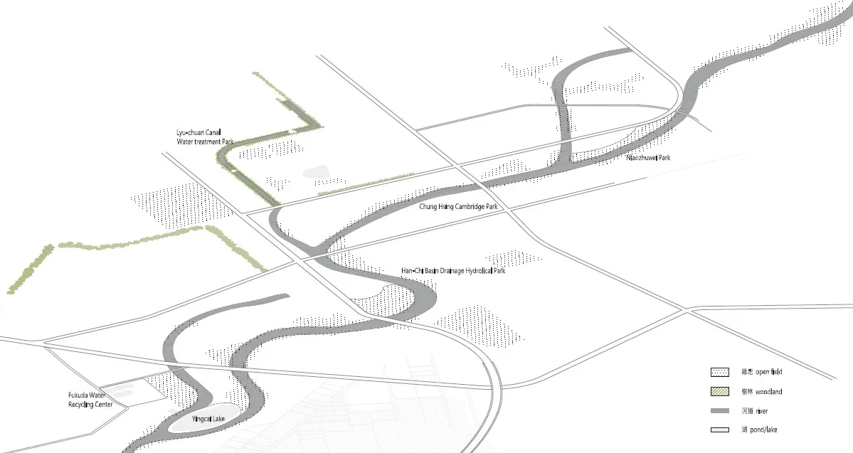
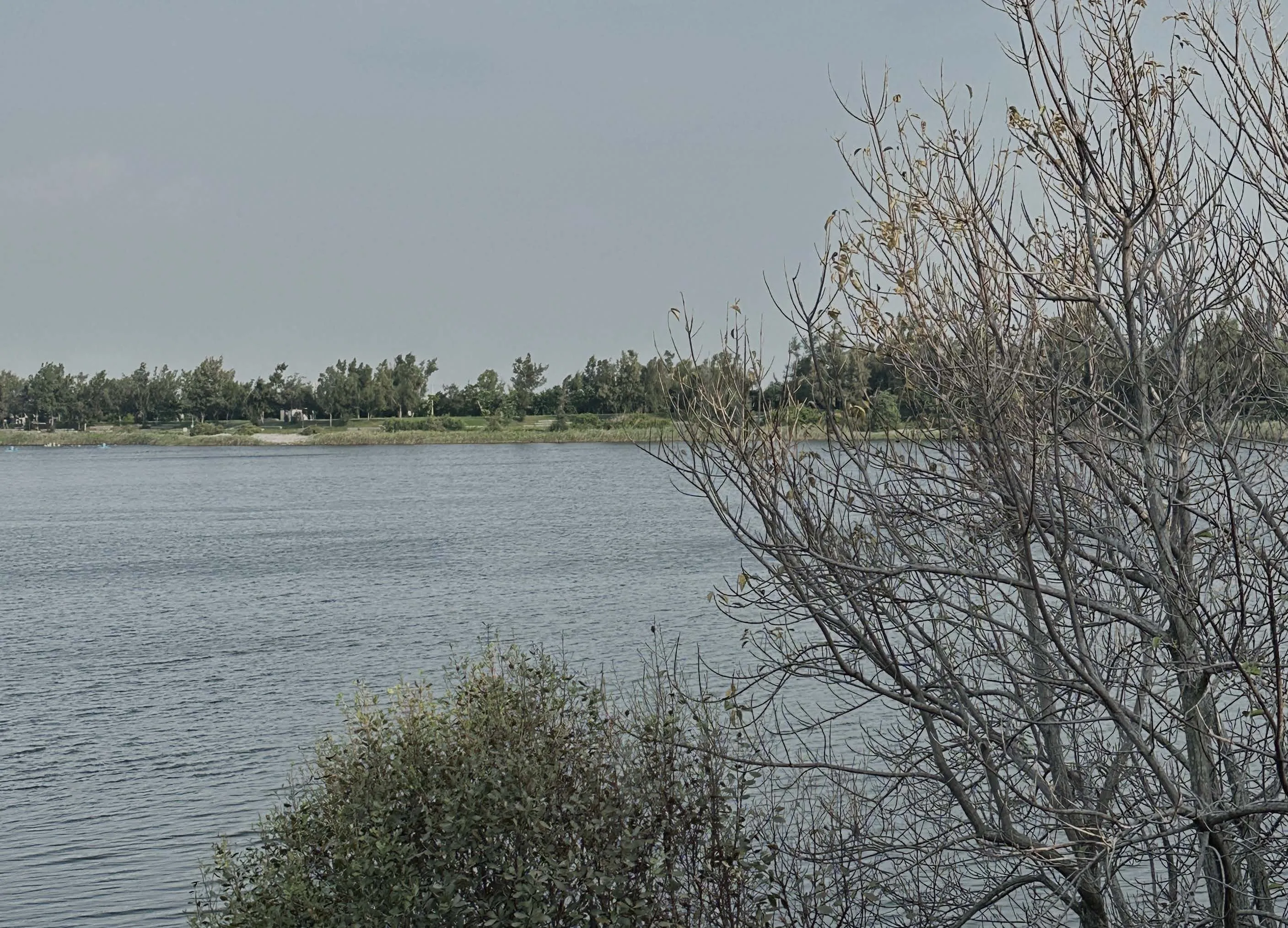
Site Sampling #2 Hanshi Drainage River Basin Riparian Area, Taichung
Originally serving as urban farmland along the riverbanks, the area featured clear patterns of terraced microfields shaped by river terrace topography. With urban expansion, this productive farmland transformed into recreational water landscapes. The once dynamic hydrological and labor landscapes were tamed into spaces of leisure and refuge for humans and wildlife.
With the removal of levees, the Hanshi River basin has gained a series of new waterfront public spaces, including Bird Bamboo Enclosure, Jacaranda Park, Xingda Cambridge, Hanshi Drainage Water Park, and the surveyed Yingcai Lake Detention Basin. This riverbank area was once urban farmland,with micro-terraces shaped by river terraces. As the city expanded, these productive lands transformed into recreational waterscapes. The once dynamic hydrological and labor landscape has been tamed into a space of leisure and refuge for both humans and wildlife.


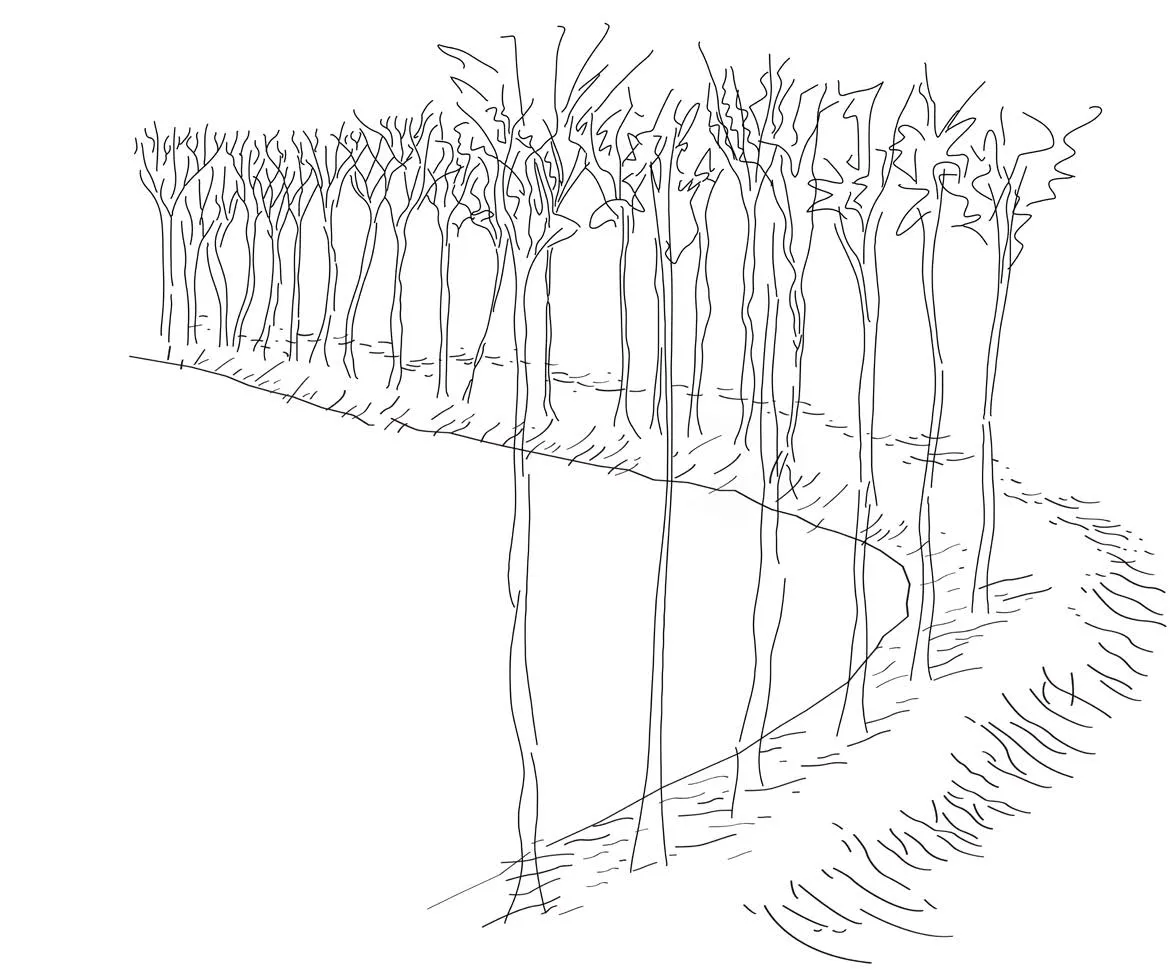
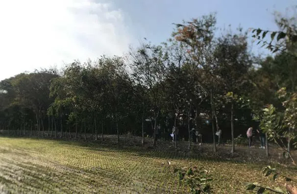

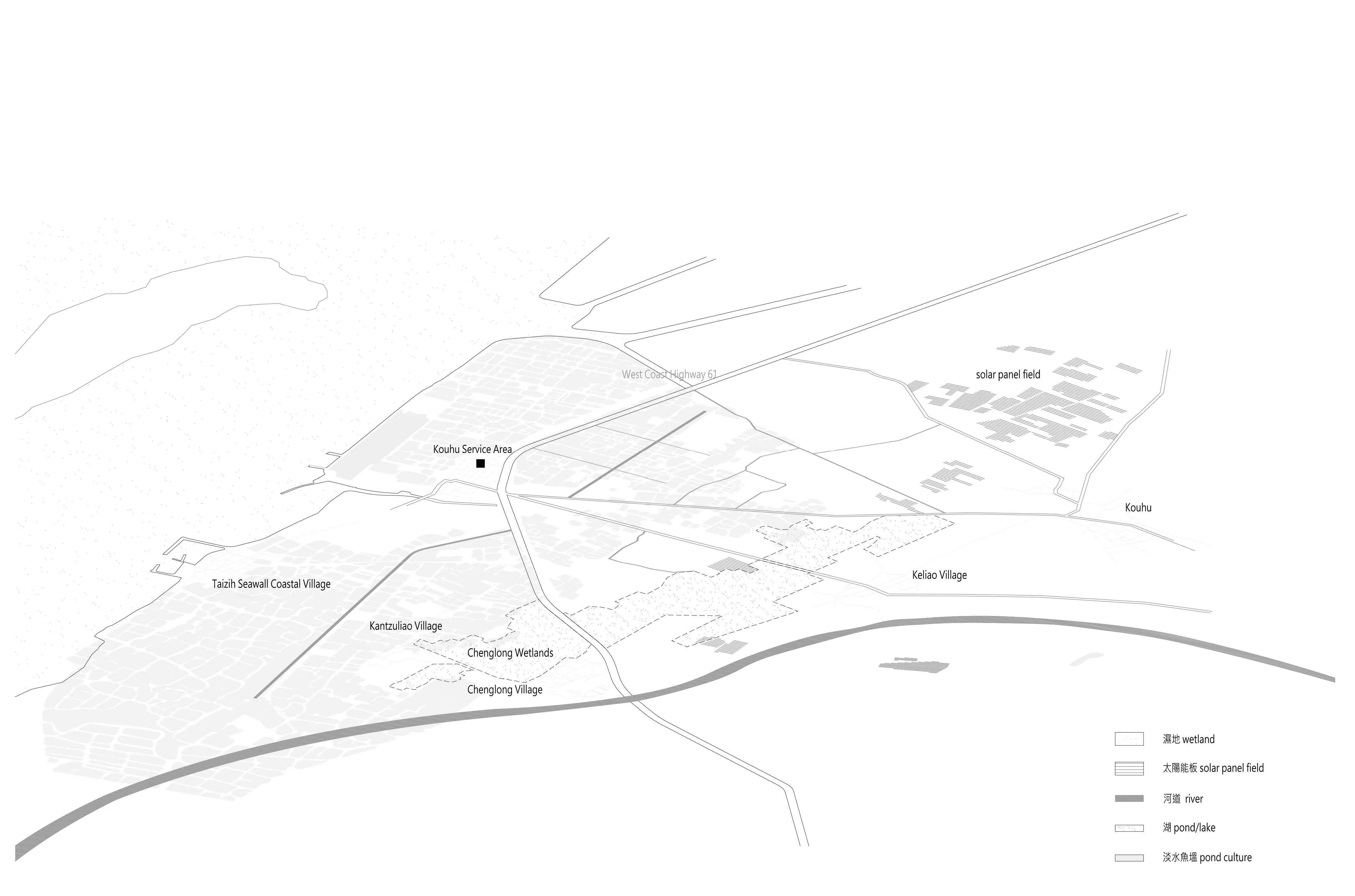
Site Sampling #3 - Multifaceted Wetlands of Chenglong Wetland
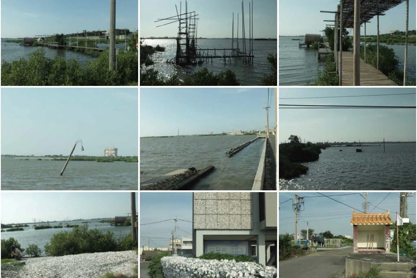
The Chenglong Wetlands are located in Kouhu Township, a historically water-rich lowland, as indicated by place names like Jinhu, Sihu, and Xiakou. The largest lagoon, Xiangling or Shuling Lake, was part of the Beigang trade network during the Qing Dynasty. Chenglong Village, formerly known as Xiakou Port or Niuniaogang, became an outer port after storm-induced siltation in the 19th century. Following the completion of the Jianan Irrigation System, coastal areas were reclaimed for agriculture, wetlands were filled, and freshwater aquaculture ponds became a defining feature of the landscape.
After the high-speed rail opened in 2006, areas along Changhua and Yunlin experienced annual subsidence of up to 5 cm, with the Taiwan Route 78 interchange in Yunlin sinking 114 cm to date.Reports primarily attribute this to excessive groundwater extraction for aquaculture, disrupting natural recharge cycles. However, historical maps show that Yunlin’s coastal wetlands and lagoons were once the norm, while dry land was a temporary human creation. Today, promoting drought-resistant crops along the coast mirrors past agricultural expansion, prioritizing speed and efficiency over food production.
The Yunlin, Chiayi, and Tainan regions are particularly sensitive to rising sea levels and land subsidence, with Yunlin being the most affected.After storms, seawater often flows backward through drainage channels, flooding adjacent lands.The West Coast Expressway, completed in sections since 1991, was elevated to avoid submersion.These high-speed corridors, built above natural terrain, have altered land use patterns in response to environmental pressures, reshaping networks.
Site Sampling #4 - The Significance of the Provisional at Yiwu Wetland, Yunlin
After multiple storms since the 1980s, areas near the intersection of Provincial Highway 17 and Yunlin Route 143 were submerged, leading to the long-term abandonment of former sugarcane farms, which eventually transformed into wetland grassland ecosystems. The Yiwu Detention Basin and the nearby Aogu Wetlands were originally part of Taiwan Sugar Corporation’s land reclamation projects. As a key player in Taiwan’s rural modernization, the corporation consolidated 1,400 privately owned sugar mills into 50 modernized factories under a centralized management system,interconnected by an extensive railway network.
After the 1980s, the Dongshi Farm in Chiayi County gradually submerged, attracting waterbirds and amphibians, and was designated as Aogu Wetlands in 2008 under the Wildlife Conservation Act. Meanwhile, the Yiwu Farm detention basin in Yunlin County became a “provisionally important wetland.” Remnants of afforestation efforts and isolated ridges within the basin now serve as coastal woodlands and bird habitats. Following Taiwan’s shift from sugar production to forestry,livestock, and land development, the 2015 greenenergy policy transformed much of the farmland,except for the detention basins, into solar fields.


Site Sampling #5 Where River Bends: Shimei’s Sugar Industrial Landscape, Tainan
Shanhua is a trade town by nature, with its surrounding rural areas interwoven with waterways and forest paths. The cattle market, aprominent agricultural-era trading hub, drove the gradual expansion of the urban center. The market moved from the old town’s edge to the northwest,evolving into a renowned nine-day monthly morning market. Today, Shanhua serves not only as a hub for industrial and economic exchanges but also as a system of biological, energy, and material interactions, structured around its waterways and forests. Its former name, “Wanli,” hints at its central sandbank location shaped by Zengwen River’s course changes, underscoring its perpetual relationship with water. Taiwan Sugar Company inherited the landscape fabric of the Japanese regime. The wide embankment of the irrigation canals originating from Shanshang treatment plant frames the agricultural plots.
During the process of regularization, old irrigation canals became the armature of Shanhua, while areas like Shiwei and Shizou evolved into its peripheral zones. The stream called Shiwei became literally the “backwater” of the settlement.
Shanhua Sugar Factory remains one of two operational sugar factories in Taiwan (the other in Huwei, Yunlin). To facilitate sugarcane cultivation,farmland often sits elevated for drainage, with visible concrete embankments. Forestry initiatives since 2010 have added expansive tree-lined corridors, such as Poincian and rosewood trees along Highway 19.
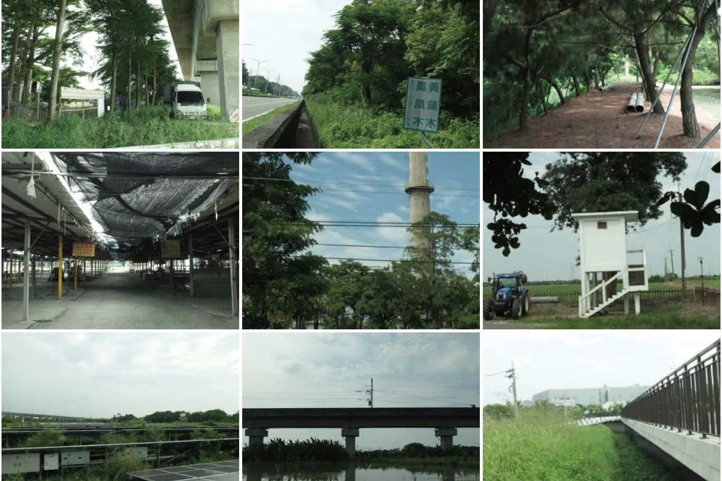


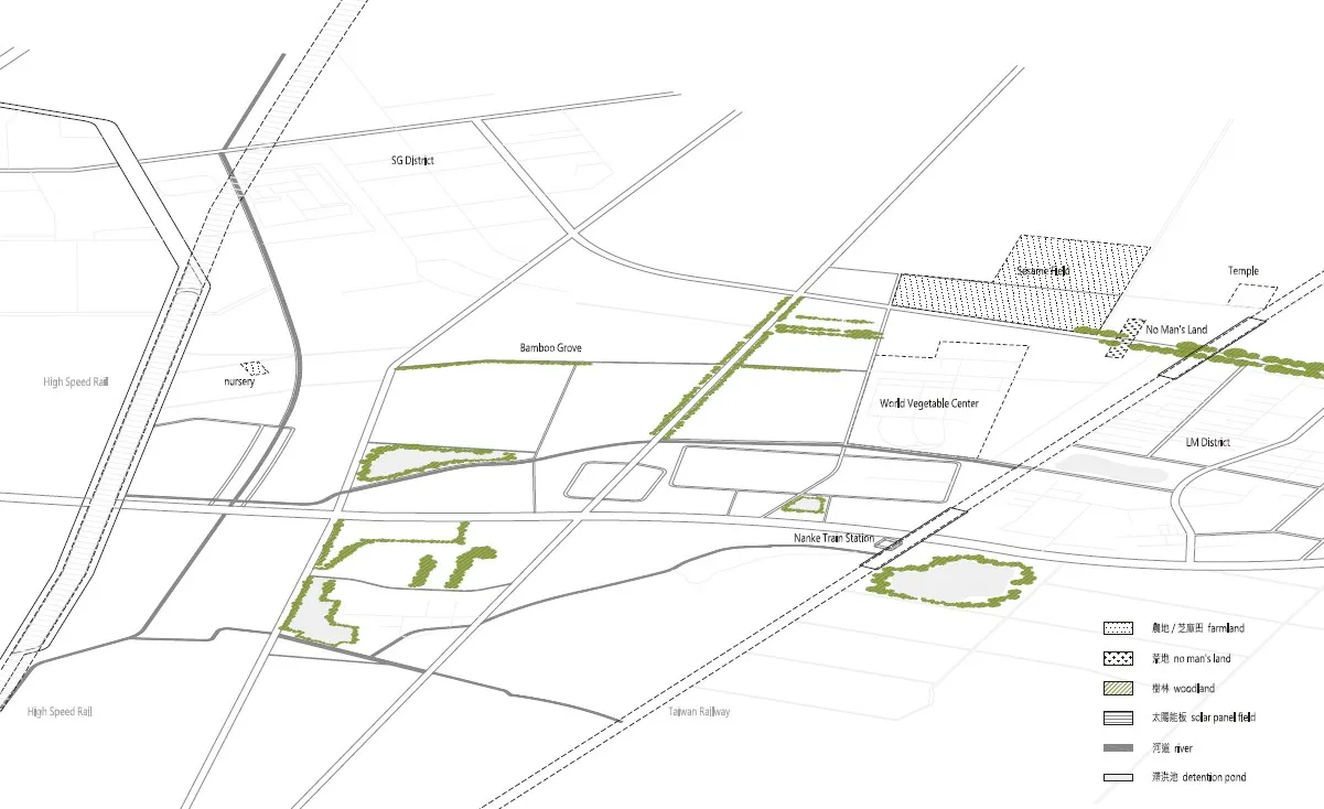
Site Sampling #6 Ecotones at Sounthern Taiwan Science Campus, Tainan
The interweaving of old and new systems has created diverse edges and wastelands, forming ecological transition zones (ecotones) in Tainan Science Park. Elevated roads like Mujialiuwan feature neem tree plantings, attracting bird gatherings and fostering bird-vehicle coexistence. These zones provide riparian habitats and connect northern and southern Shanhua through migratory corridors for waterbirds along irrigation channels.
TThe earliest institution to integrate irrigation systems into a systematic research and technology park in southern Shanhua was the Asian Vegetable Research and Development Center (AVRDC), founded in 1971. Originally a Taiwan Sugar Corporation sugarcane farm, it combined technical and political ideologies, supported by U.S.agricultural aid to strengthen Taiwan’s regional influence. Initial research focused on six crops:mung beans, soybeans, tomatoes, sweet potatoes,Irish potatoes, and Chinese cabbage, emphasizing plant protein, mineral, and vitamin production.Nearby experimental fields also cultivated local sesame, forming harvest-season conical stacks.
The subsequent development of Tainan Science Park followed the existing irrigation system,forming a new grid-like road network. Along Dashun 7th Road, a nearly 60-meter-long bamboo hedge, together with mango tree-lined paths in the AVRDC area, creates a shaded microclimate,supporting climbing plants like honeysuckle and serving as a carbon sequestration device and habitat for birds, insects, amphibians, and aquatic species. Elevated roads over the Da Zhou Drainage Channel allow water collection, while large detention ponds (Lake Lemon, Lake Xia Ke, and Lake Ying Xi) integrate into region’s evolving system.

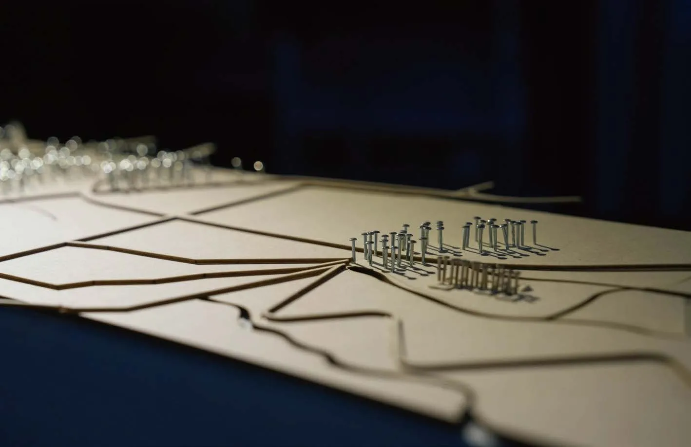
Liminal Void: Insurgent Ecologies of the Ruderal Landscape
These public spaces, seemingly ordinary voids in daily life, acquire a sense of unfamiliarity due to subtle dissonances, existing as liminal zones where the boundaries between use and neglect blur.
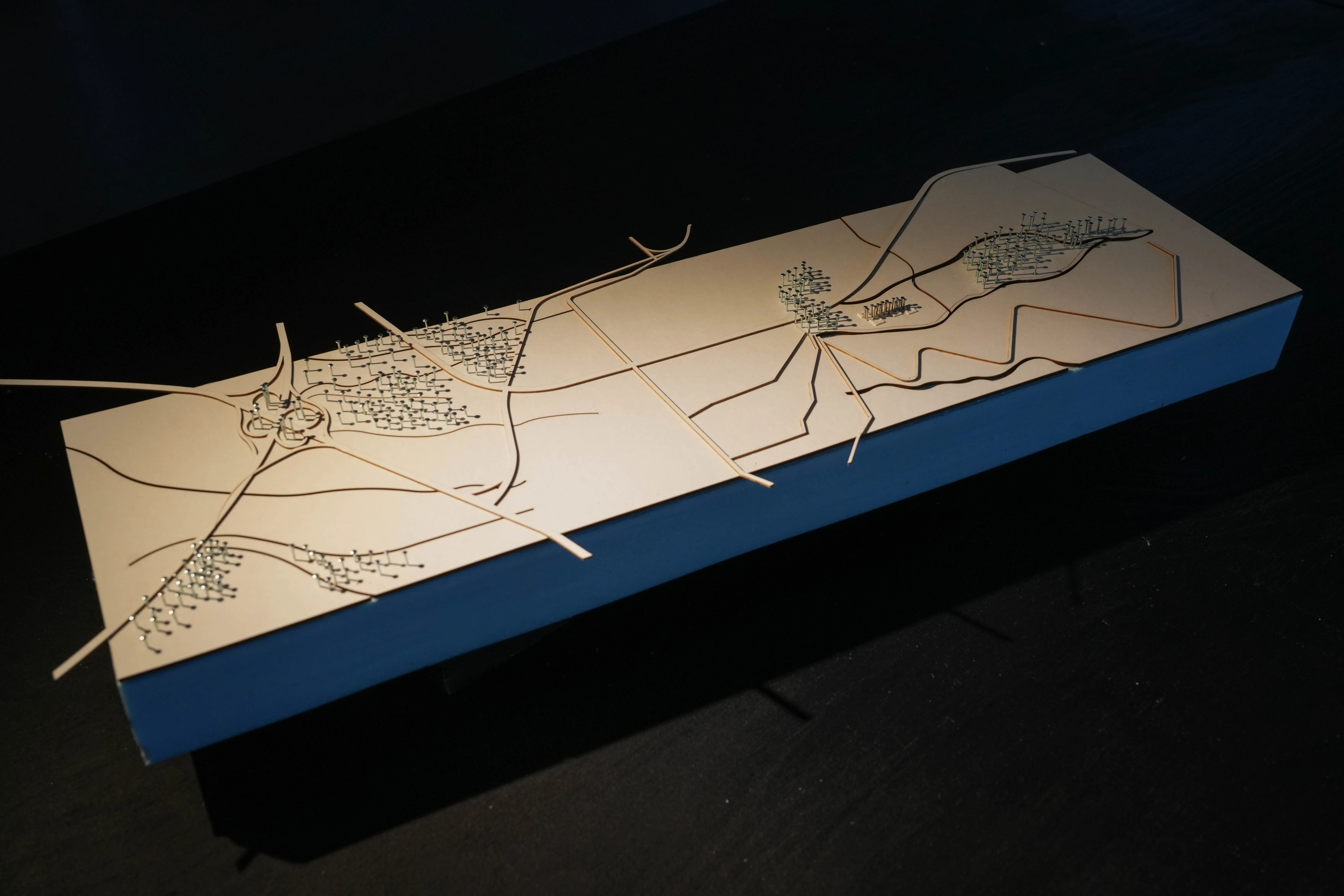
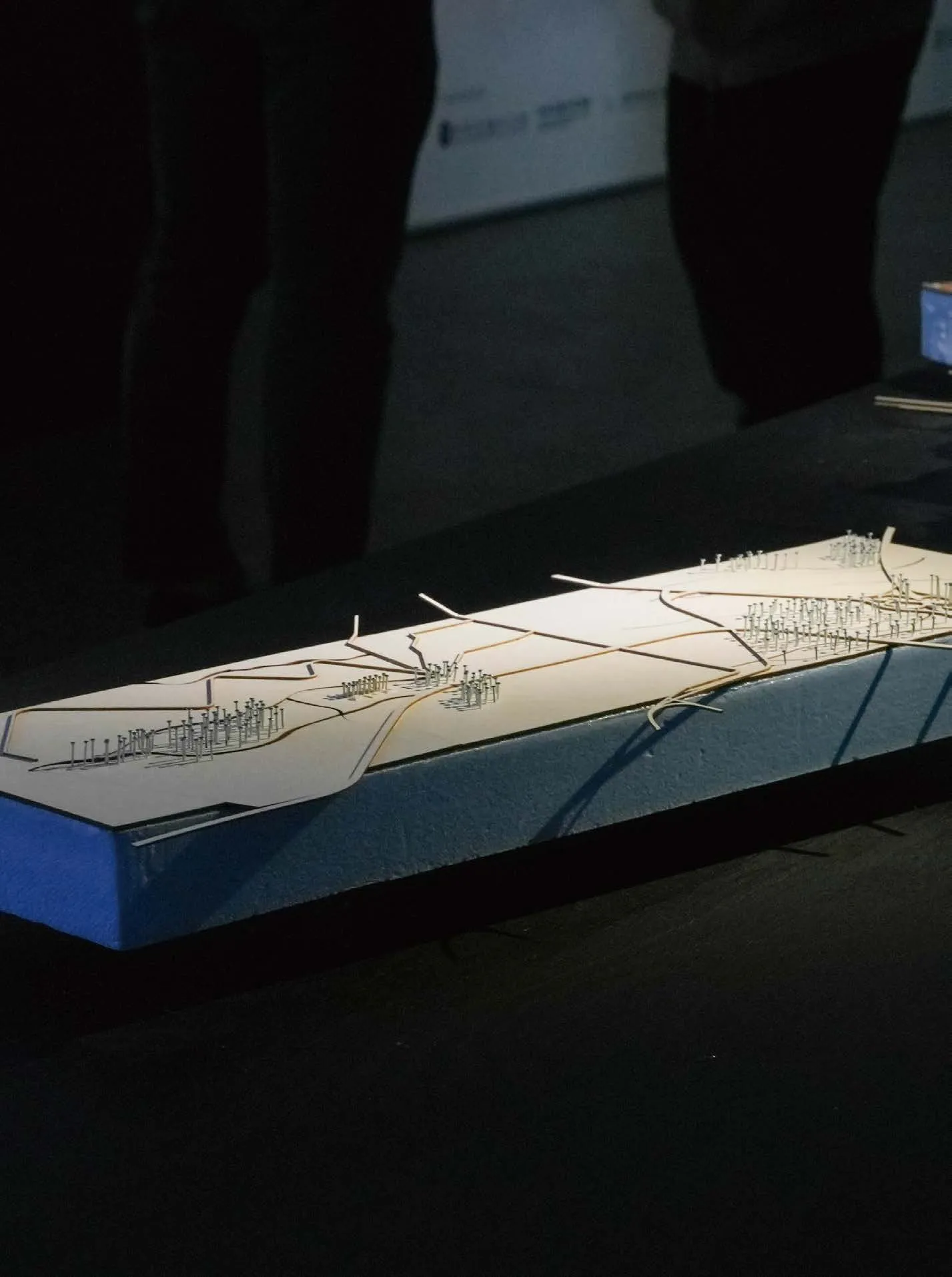
 Liminal Void: Insurgent Ecologies of the Ruderal Landscape_Model Photo by Pan-Yu Li
 Liminal Void: Insurgent Ecologies of the Ruderal Landscape_Model Photo by Pan-Yu Li
 Liminal Void: Insurgent Ecologies of the Ruderal Landscape_Model Photo by Pan-Yu Li
 iminal Void: Insurgent Ecologies of the Ruderal Landscape_Model Photo by Pan-Yu Li
 iminal Void: Insurgent Ecologies of the Ruderal Landscape_Model Photo by Pan-Yu Li
 Liminal Void: Insurgent Ecologies of the Ruderal Landscape_Model Photo by Pan-Yu Li
Bibliography
Carol Burns, “On Site: Architectural Preoccupations,” in Drawing Building Text,ed. Andrea Kahn. (New York: Princeton Architectural Press, 1991).
Chi-Hao Chang, A Study on Establishing The Firebreak of Plants , Masters Thesis, Department of Landscape Architecture, Tunghai University , 2003.
Jill Desimini, From Fallow (ORO Editions, 2019). — Cyclical City : Five Stories of Urban Transformation (Charlottesville, VA: University of Virginia Press, 2021).
Manuel Gausa etc., The Megapolis Dictionary of Advanced Architecture: City, Technology and Society in the Information Age (Barcelona:ACTAR, 2003).
Chun-Yi Ho , “Visualizing the Invisible:Monitoring and Governing Groundwater in Postwar Taiwan” , Graduate Institute of Building and Planning, National Taiwan University, Doctoral Dissertation, 2020.
Kuang-chi Hung , “From ‘Shame of Taiwan’to ‘Fatest-developing Industry’: Rethinking Industrialization of Forestry in Colonial Taiwan”, Taiwan Historical Research, Vol. 25, No. 3, September 2018, 83-140.
B. Cannon Ivers, “The Rise of Flexible Space,” and “The Culture of Change: A Personal Reading,” in B. Cannon Ivers ed., Staging Urban Landscapes:The Activation and Curation of Flexible Public Spaces (Basel: Birkhäuser, 2018).
Nina-Marie Lister, “Is Landscape Ecology?” in Doherty and Waldheim eds., Is Landscape … ?(New York, NY: Routeledge, 2016).
Rey, E., Laprise, M., Lufkin, S. (2022). Urban Brownfields: Origin, Definition, and Diversity. in Neighbourhoods in Transition. Springer, 7-45.
Yi-Chang Liu , “Changes in Prehistoric Culture of Dadu Terrace,” , Chungxien Wen Xien, No.11, 2007, 53-82。
Annalisa Metta and Maria Livia Olivetti, Wild and the City: Landscape Architecture for Lush Urbanism (Melfi: Casa Editrice Libria, 2020).
Federico Soriano, “Program,” in Manuel Gausa etc., The Megapolis Dictionary of Advanced Architecture, quoted in Anita Berrizbeitia, “Replacing Process,” in Julia Czerniak and George Hargreaves eds., Large Parks (New York:Princeton Architectural Press, 2007).
Jana VanderGoot, Architecture and the Forest Aesthetic: A New Look at Design and Resilient Urbanism (New York, NY: Routledge, 2017).
Alex Wall, “Programing the Urban Surface” in James Corner ed., Recovering the Landscape (1998) — “The Urban Surface: Shifting Fields for Curated Events,” in B. Cannon Ivers ed., Staging Urban Landscapes (2018).
Ming-Yung Wu “The Colonization and Silviculture: The Forestry Studies of Department of Forestry of The Central Research Institute of Taiwan Government–General, 1921~ 1939,” Taiwan Wen Hien v.60 no.2, 2009, 45-90.
Ping-Sheng Wu, “Survey of Tainan Sugar Industry Cultural Landscape,” , Tainan Municipal Administration of Cultural Heritage, 2020.